1
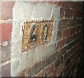
Sixty chains in to the Netherton Tunnel
The sixty chain marker (1320 yards) on the Eastern wall of the Netherton Tunnel. http://en.wikipedia.org/wiki/Netherton_Tunnel
Image: © Peter Evans
Taken: 20 Apr 2013
0.13 miles
2
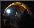
Repairs to the Netherton Tunnel
In 2011, significant cracks were found in part of the tunnel lining. Repair work began early in 2013. The section of repaired tunnel is 1465-1510 metres from the northern end.
Image: © Mat Fascione
Taken: 16 Apr 2017
0.14 miles
3
Tansley Hill Avenue Junction
The view from Oakham Road, Dudley.
Image: © Gordon Griffiths
Taken: 11 Dec 2010
0.15 miles
4
Inside the Netherton Tunnel
About 1200 metres from the southern portal.
The Netherton Tunnel was constructed between 1855–1858 and was opened on 20 August 1858 at a cost of £302,000, providing a waterway connection between the Black Country towns of Netherton and Tipton.
It lies on the Netherton Tunnel Branch Canal and has a length of 9,081 feet (2,768 m).
It was built to relieve the bottleneck of the adjacent Dudley Tunnel. The tunnel has a width of 27 feet (8.2 m) allowing two way narrowboat traffic, it has a towpath on each side.
Image: © Mat Fascione
Taken: 16 Apr 2017
0.18 miles
5
Inside the Netherton Tunnel
The tunnel is lit up by the light of an oncoming narrowboat.
The Netherton Tunnel was constructed between 1855–1858 and was opened on 20 August 1858 at a cost of £302,000, providing a waterway connection between the Black Country towns of Netherton and Tipton.
It lies on the Netherton Tunnel Branch Canal and has a length of 9,081 feet (2,768 m).
It was built to relieve the bottleneck of the adjacent Dudley Tunnel. The tunnel has a width of 27 feet (8.2 m) allowing two way narrowboat traffic, it has a towpath on each side.
Image: © Mat Fascione
Taken: 16 Apr 2017
0.20 miles
6
Narrowboat in the Netherton Tunnel
The Netherton Tunnel was constructed between 1855–1858 and was opened on 20 August 1858 at a cost of £302,000, providing a waterway connection between the Black Country towns of Netherton and Tipton.
It lies on the Netherton Tunnel Branch Canal and has a length of 9,081 feet (2,768 m).
It was built to relieve the bottleneck of the adjacent Dudley Tunnel. The tunnel has a width of 27 feet (8.2 m) allowing two way narrowboat traffic, it has a towpath on each side.
Image: © Mat Fascione
Taken: 16 Apr 2017
0.20 miles
7
Inside the Netherton Tunnel
The tunnel is lit up by the light of an oncoming narrowboat.
The Netherton Tunnel was constructed between 1855–1858 and was opened on 20 August 1858 at a cost of £302,000, providing a waterway connection between the Black Country towns of Netherton and Tipton.
It lies on the Netherton Tunnel Branch Canal and has a length of 9,081 feet (2,768 m).
It was built to relieve the bottleneck of the adjacent Dudley Tunnel. The tunnel has a width of 27 feet (8.2 m) allowing two way narrowboat traffic, it has a towpath on each side.
Image: © Mat Fascione
Taken: 16 Apr 2017
0.20 miles
8
Sharp bend on Oakham Road
Image: © Row17
Taken: 2 Sep 2010
0.21 miles
9
Netherton Tunnel
The last tunnel built at a cost of over £300,000 it opened on the 20th of August 1858. It was built with two tow paths and wide enough for two boats. Thus it eased congestion in the narrow Dudley tunnel that had to be legged through. It's over 2.5km long, straight and now unlit. Take a torch!
This is a 20 second exposure without a tripod, I plan to go again with one as some fantastic photographs are possible.
Image: © Ashley Dace
Taken: 24 Mar 2011
0.21 miles
10
Tividale Hall Primary School
Primary school on Regent Road, Oldbury, which is part of the Sandwell (Dudley) Local Authority education department.
Image: © Richard Law
Taken: 20 Jul 2012
0.23 miles


