
IMAGES TAKEN NEAR TO
Trindle Road, DUDLEY, DY2 7AZ
Introduction
This page details the photographs taken nearby to Trindle Road, DY2 7AZ by members of the Geograph project.
The Geograph project started in 2005 with the aim of publishing, organising and preserving representative images for every square kilometre of Great Britain, Ireland and the Isle of Man.

There are currently over 7.5m images from over14,400 individuals and you can help contribute to the project by visiting https://www.geograph.org.uk
Image Map
Images are licensed for reuse under creativecommons.org/licenses/by-sa/2.0
Notes
- Clicking on the map will re-center to the selected point.
- The higher the marker number, the further away the image location is from the centre of the postcode.
Image Listing (294 Images Found)
Images are licensed for reuse under creativecommons.org/licenses/by-sa/2.0
Image
Details
Distance
1
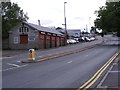
Dudley Motor Company
The view up Trindle Road with the car sales on the left hand side.
Image: © Gordon Griffiths
Taken: 13 Aug 2011
0.02 miles
2
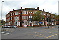
Station Hotel, Dudley
Located on the corner of Castle Hill and Trindle Road.
At the time of its opening in May 1898, the hotel was a black and white building with a courtyard and stables. It was extended and modernised in 1936 and modernised again in the 1960s.
Image: © Jaggery
Taken: 5 May 2012
0.02 miles
3
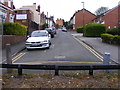
Bourne Street
The view of the Dudley street now closed at the end next to the Trindle Road dual carriageway.
Image: © Gordon Griffiths
Taken: 11 Jun 2011
0.03 miles
4
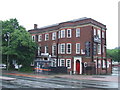
Station Hotel, Dudley
The railway station closed in 1964, but the Station Hotel is still trading.
Image: © Malc McDonald
Taken: 13 Jun 2010
0.05 miles
5

Dudley Railway Tunnel
Constructed in the 1850's
Image: © David Fisher
Taken: 29 Jun 2011
0.05 miles
6
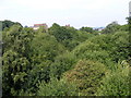
Overgrown railway
The line runs from the bottom left were it enters a tunnel diagonally to the right towards the former Dudley railway station.
Image: © Gordon Griffiths
Taken: 15 Aug 2010
0.06 miles
7

Blower's Green railway tunnel (Dudley end)
The other end of the railway tunnel seen in my photo at http://www.geograph.org.uk/photo/3259412 This line is technically mothballed awaiting conversion to Route 2 of the Midland Metro, but this looks less and less likely to happen with every passing year.
Image: © John Winder
Taken: 17 Dec 2006
0.06 miles
8
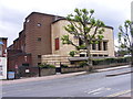
Dudley Cinema
The former Odeon cinema on Castle Hill is now used as a Jehovah Witnesses Assembly Hall for the West Midlands.
Image: © Gordon Griffiths
Taken: 13 Aug 2011
0.06 miles
9
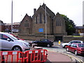
Trindle Road Church
The view of Our Lady and St Thomas of Canterbury Church on the corner of St Joseph Street Dudley from Claughton Road North. The church is one of the earliest works of the architect Augustus Pugin built in 1839.
Image: © Gordon Griffiths
Taken: 15 Aug 2010
0.06 miles
10
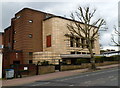
Grade II listed Jehovah's Witnesses Hall (former Odeon), Dudley
Opened in July 1937 as an Odeon cinema, designed in the Art Deco style typical of Odeons of the 1930s. It closed down in February 1975. It is currently (May 2012) an Assembly Hall of Jehovah'a Witnesses.
Grade II listed in October 2000 as "an almost complete example of a typical Odeon cinema of the 1930s, with no subdivision of the auditorium or alteration of its floor levels. The Odeons were style-leaders in cinema design of the time." [Extract from English Heritage Listing text].
Image: © Jaggery
Taken: 5 May 2012
0.06 miles