IMAGES TAKEN NEAR TO
Surrey Road, DUDLEY, DY2 0UQ
Introduction
This page details the photographs taken nearby to Surrey Road, DY2 0UQ by members of the Geograph project.
The Geograph project started in 2005 with the aim of publishing, organising and preserving representative images for every square kilometre of Great Britain, Ireland and the Isle of Man.

There are currently over 7.5m images from over14,400 individuals and you can help contribute to the project by visiting https://www.geograph.org.uk
Image Map (Loading...)


Getting Data...Please wait
Leaflet Map data © OpenStreetMap
Images are licensed for reuse under creativecommons.org/licenses/by-sa/2.0
Notes
- Clicking on the map will re-center to the selected point.
- The higher the marker number, the further away the image location is from the centre of the postcode.
Image Listing (98 Images Found)
Images are licensed for reuse under creativecommons.org/licenses/by-sa/2.0
Image
Details
Distance
1
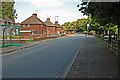
Holly Hall Road, Woodside
View in the direction of Scotts Green.
Image: © Brian Clift
Taken: 9 Sep 2009
0.07 miles
2
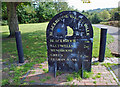
Blackbrook Valley
Sign and path leading to Park Head Locks and the Blackbrook Valley Walk. Sign is located on Holly Hall Road.
Image: © Brian Clift
Taken: 9 Sep 2009
0.09 miles
3
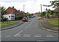
Norfolk Road, Woodside
View from Holly Hall Road.
Image: © Brian Clift
Taken: 9 Sep 2009
0.10 miles
4
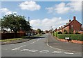
Essex Road, Woodside
View from Holly Hall Road.
Image: © Brian Clift
Taken: 9 Sep 2009
0.11 miles
5
'Prefabs' on Holly Hall Road, Dudley in 1977
Prefabs - prefabricated homes - such as these were built in large numbers in the post-WWII period as a temporary answer to the housing shortage; they had an expected life of around 10 years. Those in the image were still in place in 1977 and they presumably lasted longer. The nearest building is / was at the junction of Clee Road and Holly Hall Road. The A461 dual carriageway now slices through the location though both roads still exist according to current mapping, in 2020.
Image: © Trevor Littlewood
Taken: 8 Apr 1977
0.11 miles
6
Park Head Locks
View in the direction of Holly Hall Road, of the landscaping carried out here.
Image: © Brian Clift
Taken: 9 Sep 2009
0.12 miles
7
Holly Hall Road, Woodside
View of path leading to Park Head Locks.
Image: © Brian Clift
Taken: 9 Sep 2009
0.12 miles
8
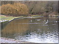
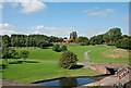
Dudley Canal Basin
The view of Park Head Basin on the Dudley No 1 Canal.
Image: © Gordon Griffiths
Taken: 11 Dec 2010
0.13 miles
9
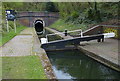
The southern portal of Dudley Tunnel
At 3,172 yards (2,900.5 m) long, it is the second longest canal tunnel on the UK canal network. It was constructed between 1775-1791, and opened on 25 June 1791.
Image: © Mat Fascione
Taken: 22 Apr 2016
0.13 miles
10
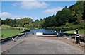
Park Head Locks
View in the direction of the Dudley Canal Tunnel.
Image: © Brian Clift
Taken: 9 Sep 2009
0.13 miles