
IMAGES TAKEN NEAR TO
Farm Road, DUDLEY, DY2 0HE
Introduction
This page details the photographs taken nearby to Farm Road, DY2 0HE by members of the Geograph project.
The Geograph project started in 2005 with the aim of publishing, organising and preserving representative images for every square kilometre of Great Britain, Ireland and the Isle of Man.

There are currently over 7.5m images from over14,400 individuals and you can help contribute to the project by visiting https://www.geograph.org.uk
Image Map
Images are licensed for reuse under creativecommons.org/licenses/by-sa/2.0
Notes
- Clicking on the map will re-center to the selected point.
- The higher the marker number, the further away the image location is from the centre of the postcode.
Image Listing (88 Images Found)
Images are licensed for reuse under creativecommons.org/licenses/by-sa/2.0
Image
Details
Distance
1
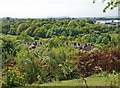
Lodge Farm Estate, Netherton
View from Netherton Hills with Saltwells Wood and the Clee Hills in the background.
Image: © Brian Clift
Taken: 11 May 2009
0.01 miles
2
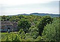
Lodge Farm Estate, Netherton
View from the Dudley No 2 Canal with Saltwells Wood and Clent Hills in the background.
Image: © Brian Clift
Taken: 11 May 2009
0.03 miles
3
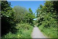
Saltwells Nature Reserve
Pathway between Hurst Lane and the Dudley No 2 Canal.
Image: © Brian Clift
Taken: 11 May 2009
0.07 miles
4
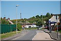
Farm Road, Netherton
The entrance to Lodge Farm Estate from Highbridge Road.
Image: © Brian Clift
Taken: 11 May 2009
0.08 miles
5
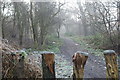
Bumble Hole Walk
View from near the Netherton Canal, in the direction of Lodge Farm Reservoir.
Image: © Brian Clift
Taken: 14 Jan 2009
0.08 miles
6
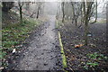
Bumble Hole Walk
This part of the pathway from the Netherton Canal was once part of a wharf for the loading of canal barges from the small rail trucks that had come from the Doulton Clay Pit.
Image: © Brian Clift
Taken: 14 Jan 2009
0.08 miles
7
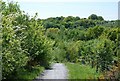
Saltwells Nature Reserve
View from the Dudley No 2 Canal in the direction of Saltwells Wood.
Image: © Brian Clift
Taken: 11 May 2009
0.09 miles
8
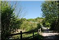
Saltwells Nature Reserve
Path and gate leading up the hill to the Dudley No 2 Canal.
Image: © Brian Clift
Taken: 11 May 2009
0.10 miles
9
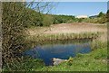
Saltwells Nature Reserve
Marsh land left here following opencast mining of the area.
Image: © Brian Clift
Taken: 11 May 2009
0.10 miles
10
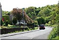
Blackbrook Close, Netherton
View from Highbridge Road in the direction of Saltwells Wood.
Image: © Brian Clift
Taken: 11 May 2009
0.10 miles