
IMAGES TAKEN NEAR TO
Hawthorne Road, DUDLEY, DY1 4BT
Introduction
This page details the photographs taken nearby to Hawthorne Road, DY1 4BT by members of the Geograph project.
The Geograph project started in 2005 with the aim of publishing, organising and preserving representative images for every square kilometre of Great Britain, Ireland and the Isle of Man.

There are currently over 7.5m images from over14,400 individuals and you can help contribute to the project by visiting https://www.geograph.org.uk
Image Map
Images are licensed for reuse under creativecommons.org/licenses/by-sa/2.0
Notes
- Clicking on the map will re-center to the selected point.
- The higher the marker number, the further away the image location is from the centre of the postcode.
Image Listing (54 Images Found)
Images are licensed for reuse under creativecommons.org/licenses/by-sa/2.0
Image
Details
Distance
1
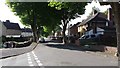
Chestnut Avenue
Complete with chestnut trees this tree-lined avenue contains Local Authority housing typical of this part of Dudley.
Image: © Peter Mackenzie
Taken: 20 Aug 2017
0.07 miles
2
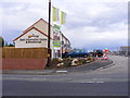
New Priory Homes
The start of a new housing estate off Priory Road, Dudley.
Image: © Gordon Griffiths
Taken: 11 Jun 2011
0.07 miles
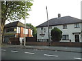
4
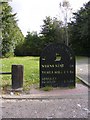
Limestone Way Sign
The sign on Castle Hill for the walk from Dudley to Sedgley Beacon.
Image: © Gordon Griffiths
Taken: 16 Sep 2009
0.10 miles
6
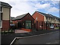
Electricity substation, Castle Mill Road, Dudley
Surrounded by newly built houses of the New Priory estate, this old electricity substation looks a little out of place. I'm not sure if it still fulfils its function or has just been left in place as a historic building.
Image: © Rudi Winter
Taken: 8 Jun 2014
0.13 miles
7
Oak Road
The view from the A4168 Priory Road in Dudley.
Image: © Gordon Griffiths
Taken: 20 Sep 2022
0.14 miles
8
St Edmunds Close
The view of a new housing estate off Priory Road, Dudley.
Image: © Gordon Griffiths
Taken: 23 Jul 2016
0.16 miles
9
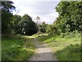
Castle Hill View
Trees planted by the Earl of Dudley in 1800 to cover the limestone workings, is now a site of importance for Nature Conservation.
Image: © Gordon Griffiths
Taken: 16 Sep 2009
0.17 miles
10
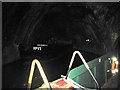
Cathedral Arch, Dudley canal
This underground canal junction within Dudley tunnel on the Dudley canal once led into Dark Cavern, a nearly 400m long limestone mine inside Castle Hill. The roof of the cavern was held up by a series of limestone pillars left in place during the mining operation. It is now backfilled after rock falls occurred. The junction has a vaulted brickwork structure which contrasts with the raw rock tunnels surrounding it. Barge No.17 sits in the stub canal, while the Dudley Canal Trust's tour boat, from which the photo was taken, moves along the main canal. Unfortunately, the fluorescent paint on the boat's railings washes out into the background in this photograph.
Castle Hill and nearby Wren's Nest are anticlines of Silurian limestone layers protruding from the surrounding Carboniferous coal beds. Both the limestone and the coal were quarried from the beginning of the industrial revolution and used in the iron smelting industry of the West Midlands of England. Mining finally ceased in 1920.
The Dudley canal was completed in 1791, running in a tunnel under Castle Hill for nearly 3km in a SSW direction. Several branch canals were built around the same time to access the limestone seams in the Castle Hill anticline, which run roughly SSE. In addition, there is a westerly branch leading to Wren's Nest. Multiple caverns have been excavated inside Castle Hill, some of which up to 800m in length. Many of the caverns have had roof collapses and rock falls and have since been backfilled. However, some are still accessible by boat through the original tunnels and a few new link tunnels built in the 1980s to enable the Dudley Canal Trust to run circular tours for visitors to see the mines. A schematic map of the canal system is shown on the Trust's website https://web.archive.org/web/20150101180643/http://www.dudleytunnel.co.uk/mines.html (archive link).
Image: © Rudi Winter
Taken: 8 Jun 2014
0.18 miles