
IMAGES TAKEN NEAR TO
Wyre Forest, Rock, KIDDERMINSTER, DY14 9UH
Introduction
This page details the photographs taken nearby to DY14 9UH by members of the Geograph project.
The Geograph project started in 2005 with the aim of publishing, organising and preserving representative images for every square kilometre of Great Britain, Ireland and the Isle of Man.

There are currently over 7.5m images from over14,400 individuals and you can help contribute to the project by visiting https://www.geograph.org.uk
Image Map
Images are licensed for reuse under creativecommons.org/licenses/by-sa/2.0
Notes
- Clicking on the map will re-center to the selected point.
- The higher the marker number, the further away the image location is from the centre of the postcode.
Image Listing (28 Images Found)
Images are licensed for reuse under creativecommons.org/licenses/by-sa/2.0
Image
Details
Distance
1

Trackbed of railway in Wyre Forest
This railway used to connect the Severn Valley Railway with Cleobury Mortimer, the line closed in August 1962.
Image: © Philip Halling
Taken: 20 Jul 2019
0.05 miles
2

We'll just go and see what's down there...
Off down the forest road to see what's worth sniffing at next.
Image: © Richard Law
Taken: 22 Aug 2020
0.09 miles
3

Two dogs on the forest road
Pinky & Perky, as we sometimes refer to them, are half-good at coming back to the whistle. There's always a scent that's quite interesting and provides an excuse not to respond straight away.
Image: © Richard Law
Taken: 22 Aug 2020
0.11 miles

5

Bridleway along the Dowles Brook at Wimperhill Wood
Wyre Forest covers an area of 26.34 square kilometres (10.17 sq mi), it straddles the borders of Worcestershire and Shropshire.
Image: © Mat Fascione
Taken: 27 Nov 2022
0.13 miles
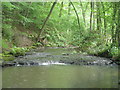
7
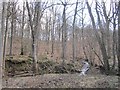
Brook meets the Dowles Brook
The stream drains the mostly oak New Parks woodland. This is the busiest part of the Wyre Forest, promoted by the Forestry Commission.
Image: © Richard Webb
Taken: 3 Apr 2013
0.15 miles
8
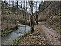
Bridleway along the Dowles Brook in the Wyre Forest
Wyre Forest covers an area of 26.34 square kilometres (10.17 sq mi), it straddles the borders of Worcestershire and Shropshire.
Image: © Mat Fascione
Taken: 27 Nov 2022
0.15 miles

10
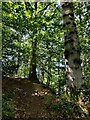
Steep path in the Wyre Forest
The Wyre Forest measures 26.34 square kilometres (10.17 sq mi), it straddles the border of Worcestershire and Shropshire. It is one of the largest areas of semi-natural (partially unmanaged) woodland in the UK.
Image: © Mat Fascione
Taken: 9 Jul 2022
0.16 miles