
IMAGES TAKEN NEAR TO
Clows Top, KIDDERMINSTER, DY14 9NY
Introduction
This page details the photographs taken nearby to DY14 9NY by members of the Geograph project.
The Geograph project started in 2005 with the aim of publishing, organising and preserving representative images for every square kilometre of Great Britain, Ireland and the Isle of Man.

There are currently over 7.5m images from over14,400 individuals and you can help contribute to the project by visiting https://www.geograph.org.uk
Image Map
Images are licensed for reuse under creativecommons.org/licenses/by-sa/2.0
Notes
- Clicking on the map will re-center to the selected point.
- The higher the marker number, the further away the image location is from the centre of the postcode.
Image Listing (6 Images Found)
Images are licensed for reuse under creativecommons.org/licenses/by-sa/2.0
Image
Details
Distance
1
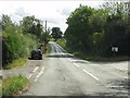
B4202 - Bayton Common crossroads
Phone box, post box and parish noticeboard feature at his nodal point.
Image: © Peter Whatley
Taken: 16 Aug 2011
0.05 miles
2
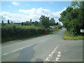
Bayton Common
Telephone box on B4202, looking south
Image: © planetearthisblue
Taken: 16 Jul 2007
0.07 miles
3
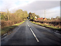
B4202 at Bayton Common
Crossroads and phone box ahead
Image: © John Firth
Taken: 27 Dec 2012
0.10 miles
4
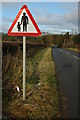
Pedestrians in road ahead
Sign warning of Pedestrians on the road on the B4202 at Baynton Common.
Image: © Philip Halling
Taken: 27 Nov 2010
0.11 miles
5
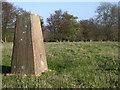
Trig point, Church Hill
This trig point is right in the SW corner of the square. At 230m the view stretches from Radnor Forest (I think) Titterstone Clee, Brown Clee, The Wrekin, Clent Hills, Cotswolds. Today looking into the sun I couldn't pick out the Malvern Hills and in any case the southern horizon is closed by the nearer bulk of Abberley Hill.
This is a really worthwhile view point (involving trespass to reach!). Not sure why it's called Church Hill, access to the trig point is via the earthworks SE of the summit shown on 1:25000 map.
Image: © Richard Greenwood
Taken: 18 Nov 2006
0.13 miles
6

Old Boundary Marker in Bayton Common
Fallen Parish Boundary Marker situated in a garden beside Hollywell Lane, Bayton Common. Formerly on the boundary of Bayton or Rock parish and Mamble parish, but now entirely in Bayton parish. Dug up by a builder and moved to the garden. Inscribed R, L or B, L. on one face (Rock or Bayton parish) and M, L. on the other face (Mamble parish). The L is thought to represent Liberty, an area in which rights reserved to the king had been devolved into private hands.
Milestone Society National ID: WO_BAYTON02pb
Image: © J Atkinson
Taken: Unknown
0.21 miles