IMAGES TAKEN NEAR TO
Mamble, KIDDERMINSTER, DY14 9JB
Introduction
This page details the photographs taken nearby to DY14 9JB by members of the Geograph project.
The Geograph project started in 2005 with the aim of publishing, organising and preserving representative images for every square kilometre of Great Britain, Ireland and the Isle of Man.

There are currently over 7.5m images from over14,400 individuals and you can help contribute to the project by visiting https://www.geograph.org.uk
Image Map
Images are licensed for reuse under creativecommons.org/licenses/by-sa/2.0
Notes
- Clicking on the map will re-center to the selected point.
- The higher the marker number, the further away the image location is from the centre of the postcode.
Image Listing (9 Images Found)
Images are licensed for reuse under creativecommons.org/licenses/by-sa/2.0
Image
Details
Distance
1
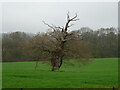
View towards Church Hill
Looking north from the A456, midway between Mamble and Clows Top.
Image: © Mat Fascione
Taken: 16 May 2012
0.05 miles
2
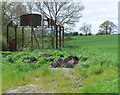
Newleys Farm :grazing sheep
Looking ENE towards Church Hill Image
Image: © Richard Greenwood
Taken: 18 Nov 2006
0.15 miles
3
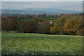
View to Brown Clee Hill
View to Brown Clee Hill from a footpath to the west of Clows Top.
Image: © Philip Halling
Taken: 27 Nov 2010
0.16 miles
4
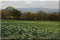
View to Clee Hill
View to Titterstone Clee Hill from a footpath to the west of Clows Top.
Image: © Philip Halling
Taken: 27 Nov 2010
0.16 miles
5
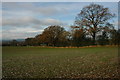
Arable land at Clows Top
Its late November and the land is frozen as a result of below average temperatures, a few leaves remain on the oak trees.
Image: © Philip Halling
Taken: 27 Nov 2010
0.18 miles
6
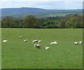
Grazing sheep next to the A456
The high ground on the horizon is Titterstone Clee Hill, nearly eight miles distant.
Image: © Mat Fascione
Taken: 16 May 2012
0.23 miles
7
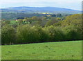
North Worcestershire countryside
The high ground on the horizon is Brown Clee Hill, part of the Shropshire Hills and the highest point in Shropshire, about 17 kilometres distant.
Image: © Mat Fascione
Taken: 16 May 2012
0.23 miles