IMAGES TAKEN NEAR TO
Clows Top, KIDDERMINSTER, DY14 9HY
Introduction
This page details the photographs taken nearby to DY14 9HY by members of the Geograph project.
The Geograph project started in 2005 with the aim of publishing, organising and preserving representative images for every square kilometre of Great Britain, Ireland and the Isle of Man.

There are currently over 7.5m images from over14,400 individuals and you can help contribute to the project by visiting https://www.geograph.org.uk
Image Map
Images are licensed for reuse under creativecommons.org/licenses/by-sa/2.0
Notes
- Clicking on the map will re-center to the selected point.
- The higher the marker number, the further away the image location is from the centre of the postcode.
Image Listing (6 Images Found)
Images are licensed for reuse under creativecommons.org/licenses/by-sa/2.0
Image
Details
Distance
1
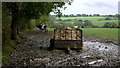
Wet field corner
The supplementary hay in the trailer is to help these cattle as the grass slows down in growth in the autumn.
Image: © Jonathan Billinger
Taken: 31 Oct 2013
0.13 miles
2
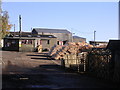
Hunthouse sawmills
This sawmill is on the site of a former colliery working as recently as 1954 -72. See http://www-users.aston.ac.uk/~poynerdr/fowcoal.htm for further information on history of Wyre Forest Coalfield
Image: © Richard Greenwood
Taken: 18 Nov 2006
0.13 miles
3
Road to Frith Common
Looking south-west.
Image: © Jonathan Billinger
Taken: 31 Oct 2013
0.15 miles
4
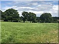
Near Foxley
The southern part of the Wyre Forest coalfield.
Image: © Richard Webb
Taken: 7 Jul 2024
0.16 miles
5
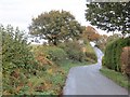
Minor road near Mamble
In the heart of the southern part of the Wyre Forest coalfield. Coal was mined here until 1950 and there are periodic attempts of starting open cast mining here.
Image: © Richard Webb
Taken: 24 Oct 2014
0.17 miles