
IMAGES TAKEN NEAR TO
Buckeridge Bank, KIDDERMINSTER, DY14 9DH
Introduction
This page details the photographs taken nearby to Buckeridge Bank, DY14 9DH by members of the Geograph project.
The Geograph project started in 2005 with the aim of publishing, organising and preserving representative images for every square kilometre of Great Britain, Ireland and the Isle of Man.

There are currently over 7.5m images from over14,400 individuals and you can help contribute to the project by visiting https://www.geograph.org.uk
Image Map
Images are licensed for reuse under creativecommons.org/licenses/by-sa/2.0
Notes
- Clicking on the map will re-center to the selected point.
- The higher the marker number, the further away the image location is from the centre of the postcode.
Image Listing (11 Images Found)
Images are licensed for reuse under creativecommons.org/licenses/by-sa/2.0
Image
Details
Distance
1
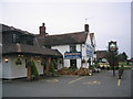
The Plough in Far Forest
This pub lies just off the main road through the hamlet of Far Forest on the edge of Wyre Forest.
Image: © O O'Brien
Taken: 24 Mar 2007
0.21 miles
2
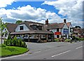
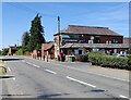
The Plough Inn, Cleobury Road
This very large pub is on the A4117 road to Cleobury Mortimer. It has established a good name for excellent food at reasonable prices, and so is deservedly popular and busy. It shows what can be done in these difficult times, with the right approach. Sadly others have not made the same effort, as can be seen further along the road towards Cleobury, where a long established rival has now been closed for several months.
Image
Image: © P L Chadwick
Taken: 19 Jun 2010
0.22 miles
3
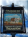
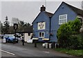
The Plough Inn (pub sign), Cleobury Road
This popular pub has established a good reputation for food, and has held its own despite there being many other pubs nearby. It is part of a small group called Nostalgia Inns. The other two are in Shropshire.
Image
Image: © P L Chadwick
Taken: 19 Jun 2010
0.22 miles
4
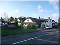
The Plough Inn, Cleobury Road, Far Forest, Worcs
A packed car park and full house speaks volumes for this village pub.
Image: © Jeremy Bolwell
Taken: 4 Dec 2012
0.23 miles
5
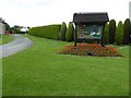
Yew Tree Farm Caravan Park
The entrance to Yew Tree Farm Caravan Park at Far Forest on the edge of the Wyre Forest.
Image: © Philip Halling
Taken: 3 Jun 2017
0.23 miles
6
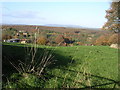
Buckridge
This area of NW Worcestershire is characterised by many steep sided valleys ultimately draining to Dowles Brook. The valley in this scene is that of Lem Brook with Wyre Forest (Cleobury Coppice) behind and Brown Clee on the skyline. The pattern of agriculture is mainly small-holdings many of which still have traditional orchards, although as "townies" take over the properties they are being grubbed up for horse paddocks - what a pity!
Image: © Richard Greenwood
Taken: 18 Nov 2006
0.23 miles
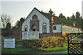
10
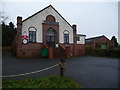
Far Forest Village Hall
A proud and well maintained village hall.
Image: © Jeremy Bolwell
Taken: 26 Nov 2012
0.25 miles