IMAGES TAKEN NEAR TO
Stottesdon, KIDDERMINSTER, DY14 8LR
Introduction
This page details the photographs taken nearby to DY14 8LR by members of the Geograph project.
The Geograph project started in 2005 with the aim of publishing, organising and preserving representative images for every square kilometre of Great Britain, Ireland and the Isle of Man.

There are currently over 7.5m images from over14,400 individuals and you can help contribute to the project by visiting https://www.geograph.org.uk
Image Map
Images are licensed for reuse under creativecommons.org/licenses/by-sa/2.0
Notes
- Clicking on the map will re-center to the selected point.
- The higher the marker number, the further away the image location is from the centre of the postcode.
Image Listing (5 Images Found)
Images are licensed for reuse under creativecommons.org/licenses/by-sa/2.0
Image
Details
Distance
2
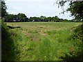
Hay field
Actually at this stage it is impossible to be sure if hay or silage is being made here, it is still early in the season which would favour silage.
Image: © Philip Halling
Taken: 14 Jun 2017
0.13 miles
3
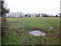
Lower Woodend
Puddle in a grass field.
Image: © Richard Webb
Taken: 14 Feb 2015
0.15 miles
5
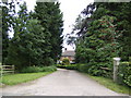
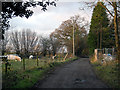
Road to Coombe Farm, Bagginswood
Image: © Jonathan Billinger
Taken: 30 Jul 2007
0.23 miles