IMAGES TAKEN NEAR TO
Ronhill Lane, KIDDERMINSTER, DY14 8AU
Introduction
This page details the photographs taken nearby to Ronhill Lane, DY14 8AU by members of the Geograph project.
The Geograph project started in 2005 with the aim of publishing, organising and preserving representative images for every square kilometre of Great Britain, Ireland and the Isle of Man.

There are currently over 7.5m images from over14,400 individuals and you can help contribute to the project by visiting https://www.geograph.org.uk
Image Map
Images are licensed for reuse under creativecommons.org/licenses/by-sa/2.0
Notes
- Clicking on the map will re-center to the selected point.
- The higher the marker number, the further away the image location is from the centre of the postcode.
Image Listing (113 Images Found)
Images are licensed for reuse under creativecommons.org/licenses/by-sa/2.0
Image
Details
Distance
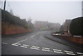
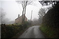
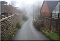
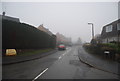
1
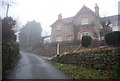
House at the top of Ron Hill
A short sharp incline entering Cleobury Mortimer.
Image: © N Chadwick
Taken: 29 Dec 2010
0.02 miles
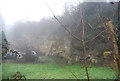
8
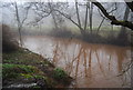
River Rea
The red colour suggests the local geology is Old Red Sandstone.
Image: © N Chadwick
Taken: 29 Dec 2010
0.11 miles
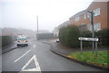
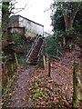
10
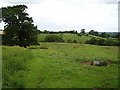
Edge of town
Field just outside Cleobury Mortimer. The path runs from the primary school, northwards.
Image: © Richard Webb
Taken: 21 Jun 2006
0.13 miles