
IMAGES TAKEN NEAR TO
Doddington Heights Park, Earls Ditton Lane, KIDDERMINSTER, DY14 0NE
Introduction
This page details the photographs taken nearby to Doddington Heights Park, Earls Ditton Lane, DY14 0NE by members of the Geograph project.
The Geograph project started in 2005 with the aim of publishing, organising and preserving representative images for every square kilometre of Great Britain, Ireland and the Isle of Man.

There are currently over 7.5m images from over14,400 individuals and you can help contribute to the project by visiting https://www.geograph.org.uk
Image Map
Images are licensed for reuse under creativecommons.org/licenses/by-sa/2.0
Notes
- Clicking on the map will re-center to the selected point.
- The higher the marker number, the further away the image location is from the centre of the postcode.
Image Listing (28 Images Found)
Images are licensed for reuse under creativecommons.org/licenses/by-sa/2.0
Image
Details
Distance
1
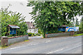
Doddington Lodge
Care home developed from a large house built in the 1849 as rectory for St John's Church. In 1910 it passed to private ownership, other than a period in the Second World War when it was used by RAF and WAAF personnel attached to the radar station on Titterstone Clee Hill.
Image: © Ian Capper
Taken: 6 Aug 2020
0.15 miles
2
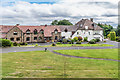
Doddington Lodge
Care home developed from a large house built in the 1849 as rectory for St John's Church. In 1910 it passed to private ownership, other than a period in the Second World War when it was used by RAF and WAAF personnel attached to the radar station on Titterstone Clee Hill.
Image: © Ian Capper
Taken: 6 Aug 2020
0.15 miles
3
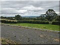
Countryside from Doddington
Viewed from the car park at Doddington village hall, with the lower car park evident in the foreground of this viewpoint.
Image: © Fabian Musto
Taken: 10 Jul 2024
0.18 miles
4
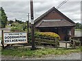
Doddington Village Hall
We parked here to visit the village church of St. John the Baptist, and the views from the car park are excellent.
Image: © Fabian Musto
Taken: 10 Jul 2024
0.19 miles
5
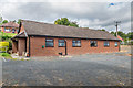
Doddington Village Hall
Village hall for Doddington. A plaque in the porch gives a building date of 1979.
Image: © Ian Capper
Taken: 6 Aug 2020
0.19 miles
6
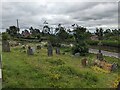
Churchyard at St. John the Baptist church (Doddington)
The grade II listed war memorial can be seen to the right of this viewpoint, and the A4117 road can also be seen behind the churchyard.
Image: © Fabian Musto
Taken: 10 Jul 2024
0.21 miles
7
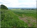
View to the south east over farmland
View to the south east over farmland over southern Shropshire to Worcestershire and the Malvern Hills from near Doddington.
Image: © Philip Halling
Taken: 14 Jun 2017
0.22 miles
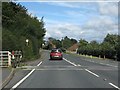
9
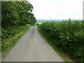
Road from Doddington to Earls Ditton
Country road descending from Doddington to Earls Ditton.
Image: © Philip Halling
Taken: 14 Jun 2017
0.22 miles
10
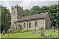
Church of St John the Baptist, Doddington
Church built in 1849, branded "the Church on the Hill" given its position on the slopes of Titterstone Clee Hill. Grade II listed - see www.historicengland.org.uk/listing/the-list/list-entry/1383554.
Image: © Ian Capper
Taken: 6 Aug 2020
0.23 miles