
IMAGES TAKEN NEAR TO
Crumps Brook, KIDDERMINSTER, DY14 0HY
Introduction
This page details the photographs taken nearby to Crumps Brook, DY14 0HY by members of the Geograph project.
The Geograph project started in 2005 with the aim of publishing, organising and preserving representative images for every square kilometre of Great Britain, Ireland and the Isle of Man.

There are currently over 7.5m images from over14,400 individuals and you can help contribute to the project by visiting https://www.geograph.org.uk
Image Map
Images are licensed for reuse under creativecommons.org/licenses/by-sa/2.0
Notes
- Clicking on the map will re-center to the selected point.
- The higher the marker number, the further away the image location is from the centre of the postcode.
Image Listing (6 Images Found)
Images are licensed for reuse under creativecommons.org/licenses/by-sa/2.0
Image
Details
Distance
1
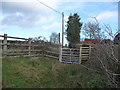
Gate on the edge of Catherton Common near Crumpsbrook
A seldom used gate I think.
Image: © Jeremy Bolwell
Taken: 25 Nov 2011
0.06 miles
4
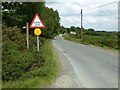
Country road crossing Catherton Common
Country road approaching a cattle grid on the edge of Catherton Common.
Image: © Philip Halling
Taken: 14 Jun 2017
0.09 miles
5
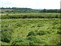
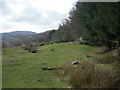
Rough grazing on Catherton Common
Catherton Common is a large expanse of rough open grazing land to the east of Titterstone Clee Hill. Here is bordering on heathland.
Image: © Philip Halling
Taken: 14 Jun 2017
0.15 miles
6
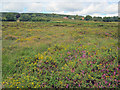
Catherton Common
View north-west towards Silvington Common. This large area of heathland is an important wildlife habitat. The area south of Hill Houses is a mix of gorse and heather, which makes a colourful display in late August. The bridleway looks good on the map, but is non-existent in reality, so the gorse makes it a tricky crossing on foot.
Image: © Trevor Rickard
Taken: 22 Aug 2010
0.21 miles