
IMAGES TAKEN NEAR TO
Silvington Hill, KIDDERMINSTER, DY14 0ER
Introduction
This page details the photographs taken nearby to Silvington Hill, DY14 0ER by members of the Geograph project.
The Geograph project started in 2005 with the aim of publishing, organising and preserving representative images for every square kilometre of Great Britain, Ireland and the Isle of Man.

There are currently over 7.5m images from over14,400 individuals and you can help contribute to the project by visiting https://www.geograph.org.uk
Image Map
Images are licensed for reuse under creativecommons.org/licenses/by-sa/2.0
Notes
- Clicking on the map will re-center to the selected point.
- The higher the marker number, the further away the image location is from the centre of the postcode.
Image Listing (10 Images Found)
Images are licensed for reuse under creativecommons.org/licenses/by-sa/2.0
Image
Details
Distance
1
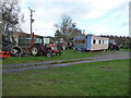
Tractor collection on a smallholding on Silvington Hill
At least four oldish tractors are parked up in this field alone. More stand in adjacent fields.
Image: © Jeremy Bolwell
Taken: 25 Nov 2011
0.10 miles
2
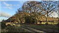
The Jack Mytton Way
Here is the Jack Mytton Way on Silvington Common. This is a long distance footpath and bridleway for horseriders, hillwalkers and mountain bikers that lasts for 93 miles (150 km) in mid and south Shropshire.
Image: © Fabian Musto
Taken: 13 Jan 2023
0.12 miles

4
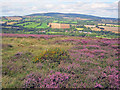
Silvington Common
View north towards Brown Clee Hill in the distance. Silvington village in the valley below.
Image: © Trevor Rickard
Taken: 22 Aug 2010
0.16 miles
5
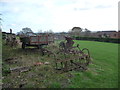
Old farm machinery in a field corner below Silvington Hill
Yet another one of those dumping grounds for obsolete items whose days of usefulness are really long behind them.
Image: © Jeremy Bolwell
Taken: 25 Nov 2011
0.19 miles
6
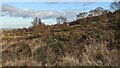
Silvington Common
Viewed from a public footpath that descends from Silvington Common to the village of Silvington.
Image: © Fabian Musto
Taken: 13 Jan 2023
0.20 miles
7

Part of the Jack Mytton Way on Silvington Common
A bank and ditch arrangement mark the boundary of the wood to the left, with the open common to the right or the east.
Image: © Jeremy Bolwell
Taken: 25 Nov 2011
0.20 miles
8
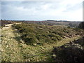
Path junction on Catherton Common
Great heathland walking on the pretty common.
Image: © Jeremy Bolwell
Taken: 5 Jan 2012
0.20 miles
9

Track across Silvington Common
Heading south-west towards Clee Hill in the distance. Rabbithouse Covert on the left.
Image: © Trevor Rickard
Taken: 22 Aug 2010
0.20 miles
10
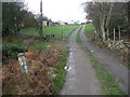
Waymarker post on Catherton Common
A junction of farm access track and a few footpath and waymarked walk routes.
Image: © Jeremy Bolwell
Taken: 25 Nov 2011
0.25 miles