
IMAGES TAKEN NEAR TO
The Broadway, DUDLEY, DY1 3DX
Introduction
This page details the photographs taken nearby to The Broadway, DY1 3DX by members of the Geograph project.
The Geograph project started in 2005 with the aim of publishing, organising and preserving representative images for every square kilometre of Great Britain, Ireland and the Isle of Man.

There are currently over 7.5m images from over14,400 individuals and you can help contribute to the project by visiting https://www.geograph.org.uk
Image Map
Images are licensed for reuse under creativecommons.org/licenses/by-sa/2.0
Notes
- Clicking on the map will re-center to the selected point.
- The higher the marker number, the further away the image location is from the centre of the postcode.
Image Listing (57 Images Found)
Images are licensed for reuse under creativecommons.org/licenses/by-sa/2.0
Image
Details
Distance
1
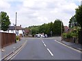
Limepit Lane
The view along Limepit Lane, Dudley.
Image: © Gordon Griffiths
Taken: 9 Jul 2018
0.01 miles
2
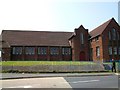
Mount Olivet First United Church of Jesus Christ Apostolicmore
Image: © Stephen Rogerson
Taken: 4 Jul 2013
0.05 miles
3
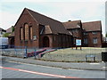
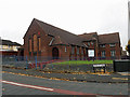
Mount Olivet First United Church of Jesus Christ Apostolic
The name is a bit of a mouthful!
Image: © Richard Law
Taken: 8 Jul 2010
0.06 miles
6
Reservoir View
The view of Shavers End Reservoir from Limepit Lane, Dudley.
Image: © Gordon Griffiths
Taken: 9 Jul 2018
0.09 miles
7
View up The Broadway
The view up the road in Dudley.
Image: © Gordon Griffiths
Taken: 3 Nov 2016
0.09 miles
8
Acacia Close
The view from Holly Road in Dudley West Midlands.
Image: © Gordon Griffiths
Taken: 9 Jul 2018
0.09 miles
9
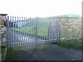
Shaver's End No 1 Reservoir
On the ridge line between Wren's Nest and Castle Hill.
Image: © John M
Taken: 20 Jan 2007
0.09 miles
10
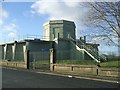
Shaver's End No. 2 Reservoir
Water supply reservoir on the continuation of the Wren's Nest/Castle Hill ridges. The limestone ridge forms the watershed between the River Severn and River Trent catchments.
Image: © John M
Taken: 20 Jan 2007
0.10 miles