IMAGES TAKEN NEAR TO
DY13 9FP
Introduction
This page details the photographs taken nearby to DY13 9FP by members of the Geograph project.
The Geograph project started in 2005 with the aim of publishing, organising and preserving representative images for every square kilometre of Great Britain, Ireland and the Isle of Man.

There are currently over 7.5m images from over14,400 individuals and you can help contribute to the project by visiting https://www.geograph.org.uk
Image Map
Images are licensed for reuse under creativecommons.org/licenses/by-sa/2.0
Notes
- Clicking on the map will re-center to the selected point.
- The higher the marker number, the further away the image location is from the centre of the postcode.
Image Listing (94 Images Found)
Images are licensed for reuse under creativecommons.org/licenses/by-sa/2.0
Image
Details
Distance
1
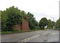
Remains of demolished railway bridge (1), Hartlebury Road
On the left, is all that remains of the former bridge, which carried a branch line down to the power station by the River Severn. The power station has gone too. The bridge crossed Hartlebury Road, which is the B4193. The route continued along what is now a road, seen on the right, called Millfields Drive. This road, built several years ago, is not shown on the OS map currently displayed on GeoGraph (September 2010). The map continues to show the road as a dismantled railway line.
Image
Image: © P L Chadwick
Taken: 19 Sep 2010
0.06 miles
2
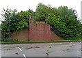
Remains of demolished railway bridge (2), Hartlebury Road
This view of the remains of the former railway bridge, is taken from Millfields Drive, which is built on part of the branch line's former route. See also:- Image
Image: © P L Chadwick
Taken: 19 Sep 2010
0.06 miles
3
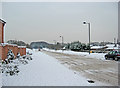
Millfields Drive in snow
Even in fine weather this road can look quite bleak; in the snow it looks even more so. It is built on part of the branch railway line that used to go down to a now demolished power station by the River Severn.
Image: © P L Chadwick
Taken: 21 Dec 2010
0.07 miles
4
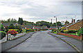
Mill Close
Mill Close is a residential road and cul-de-sac, containing bungalows. It is a turning off Mill Road.
Image: © P L Chadwick
Taken: 19 Sep 2010
0.10 miles
5
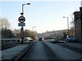
Change of Use
The railway abutment on the right reveals that the road on the left has been built on the formation of the old railway connection to Stourport power station. The main route is the B4193 to Hartlebury.
Image: © Peter Whatley
Taken: 3 Jan 2009
0.10 miles
6
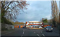
Roundabout at junction of A4025 and Hartlebury Road, Stourport-on-Severn
This roundabout was recently rebuilt to a much simplified design after two drivers managed to crash their vehicles into the stone wall that used to enclose it, both within a very short space of time. Faced with the resulting mess and taking into account the average level of driving skill in the Wyre Forest District (running through red lights a speciality) the Council presumably decided they needed a design which offered less structures to collide with. However you can be sure it won't be long before the signs on this roundabout get dented or bent over.
The road coming in from the right is Hartlebury Road. The building on the far side of the roundabout is Riverside Business Centre. Photographed from Worcester Road, part of the A4025.
Image: © P L Chadwick
Taken: 26 Jan 2019
0.10 miles
7
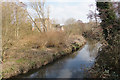
The River Stour above Stourport-on-Severn
Gently approaching the town through winter scrub, and viewed from Millfields Drive.
Image: © Bill Boaden
Taken: 23 Feb 2018
0.10 miles
8
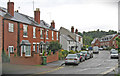
Mill Road (1)
This part of the road has a mix of old and new housing. It leads on, in this direction, to very new housing developments.
Image
Image: © P L Chadwick
Taken: 19 Sep 2010
0.11 miles
9
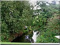
River Stour near Millfields Drive
Stourport's "other river" is very discreet and not often seen, as it meanders its way through the town, on its journey to meet the River Severn. Look carefully, and you can see an angler on the left bank.
Image: © P L Chadwick
Taken: 19 Sep 2010
0.12 miles