
IMAGES TAKEN NEAR TO
Moor Hall Lane, STOURPORT-ON-SEVERN, DY13 8RA
Introduction
This page details the photographs taken nearby to Moor Hall Lane, DY13 8RA by members of the Geograph project.
The Geograph project started in 2005 with the aim of publishing, organising and preserving representative images for every square kilometre of Great Britain, Ireland and the Isle of Man.

There are currently over 7.5m images from over14,400 individuals and you can help contribute to the project by visiting https://www.geograph.org.uk
Image Map
Images are licensed for reuse under creativecommons.org/licenses/by-sa/2.0
Notes
- Clicking on the map will re-center to the selected point.
- The higher the marker number, the further away the image location is from the centre of the postcode.
Image Listing (371 Images Found)
Images are licensed for reuse under creativecommons.org/licenses/by-sa/2.0
Image
Details
Distance
1
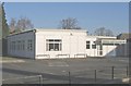
Social Day Centre, New Street
This utilitarian building houses Stourport's Social Day Centre. It provides contact for local retired people by providing social activities and on certain days of the week it provides lunchtime meals. It's a pity that such a worthwhile provision should be housed in a building which looks totally out of character with all those nearby.
Image: © P L Chadwick
Taken: 3 Jan 2009
0.11 miles
2
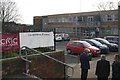
Stourport on Severn Civic Centre
Discussing matters of importance outside Stourport on Severn Civic Centre.
Image: © Derek Bennett
Taken: 23 Nov 2015
0.11 miles
3
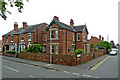
Housing on Lickhill Road in Stourport, Worcestershire
This is at the junction of Vernon Road and Lickhill Road.
Image: © Roger Kidd
Taken: 20 Jun 2013
0.11 miles
4
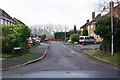
Galahad Way, Stourport-on-Severn, Worcs
Galahad Way is a residential road and this short spur off is also called Galahad Way.
Image: © P L Chadwick
Taken: 9 Jan 2021
0.12 miles
5
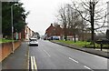
New Street, Stourport-on-Severn, Worcs
New Street is partly residential and partly business. The latter are mainly professional offices plus one public house. The Civic Centre is also in this street on the right, but not visible in this photograph. This view is looking in the direction of the town centre.
Image: © P L Chadwick
Taken: 9 Jan 2021
0.12 miles
6
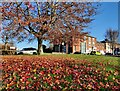
Tree outside the Stourport-on-Severn Civic Centre
Image: © Mat Fascione
Taken: 22 Nov 2021
0.12 miles
8
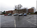
The Civic, Stourport
This is the civic centre that houses the library, council offices and the Worcestershire Coroner's service. I had been to say hello to the Coroner's Officers as I used to work with them professionally. Like many public servants they work hard and are not always appreciated.
Image: © Chris Allen
Taken: 28 Nov 2019
0.12 miles
9
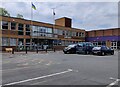
Stourport-on-Severn Library and Civic Centre
Image: © Mat Fascione
Taken: 4 Jun 2022
0.13 miles
10
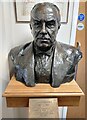
Bust of Stanley Baldwin
Inside Stourport-on-Severn Library.
Stanley Baldwin (1867-1947) was born in nearby Bewdley, and died in Stourport-on-Severn.
Image: © Mat Fascione
Taken: 11 Mar 2022
0.13 miles