
IMAGES TAKEN NEAR TO
Areley Lane, STOURPORT-ON-SEVERN, DY13 0TA
Introduction
This page details the photographs taken nearby to Areley Lane, DY13 0TA by members of the Geograph project.
The Geograph project started in 2005 with the aim of publishing, organising and preserving representative images for every square kilometre of Great Britain, Ireland and the Isle of Man.

There are currently over 7.5m images from over14,400 individuals and you can help contribute to the project by visiting https://www.geograph.org.uk
Image Map
Images are licensed for reuse under creativecommons.org/licenses/by-sa/2.0
Notes
- Clicking on the map will re-center to the selected point.
- The higher the marker number, the further away the image location is from the centre of the postcode.
Image Listing (316 Images Found)
Images are licensed for reuse under creativecommons.org/licenses/by-sa/2.0
Image
Details
Distance
1
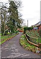
Lane off Areley Lane, Stourport-on-Severn
A private road giving access to various properties. There is a public bridleway running along it which gives access to the River Severn, near Stourport Bridge.
Image: © P L Chadwick
Taken: 19 Feb 2012
0.03 miles
3
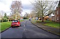
Cedar Close, Stourport-on-Severn
Cedar Close is a supported housing development consisting of forty nine flats and bungalows, with resident management staff. It is managed by Wyre Forest Sheltered Housing, which is an Industrial and Provident Society with charitable status and registered with the Housing Corporation.
Image: © P L Chadwick
Taken: 19 Feb 2012
0.05 miles
4
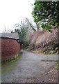
Lane to Areley Lane, Stourport-on-Severn
A private road, over which a public bridleway starting at the riverbank of the River Severn runs. On the right is the start of an access drive to Areley Hall, a timber-framed and brick house dating from the late 16th century. There is no public access over the drive.
Image: © P L Chadwick
Taken: 19 Feb 2012
0.06 miles
5
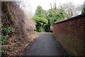
Lane from Areley Lane to the River Severn, Stourport-on-Severn
A private road, off Areley Lane, over which a public bridleway runs down to the riverbank. On the left is the start of an access drive to Areley Hall, a timber-framed and brick house dating from the late 16th century. There is no public access over the drive.
Image
Image: © P L Chadwick
Taken: 19 Feb 2012
0.07 miles
6
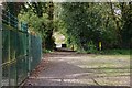
Start of public footpath to Areley Lane, Stourport-on-Severn, Worcs
The gate marks the point where a public footpath to Areley Lane commences. The area in the foreground is the Arboretum, a small collection of various trees. The fence on the left encloses Severn Trent Water's Sewage Pumping Station.
Image: © P L Chadwick
Taken: 10 Apr 2021
0.07 miles
7
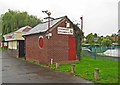
Stourport Steamer Company ticket office, Riverside Meadows, Stourport-on-Severn
The company offer tourist trips on the River Severn but not at this time of year.
Image: © P L Chadwick
Taken: 13 Oct 2013
0.07 miles
8
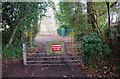
Gate to the riverside, Stourport-on-Severn
This is the end of a private road from Areley Lane, over which there is a public bridleway. People and horses can go around the gate, which is presumably here to ensure that only authorised vehicles can get to the riverside, which is in the background. Once past the gate, walkers can go in either direction along a public footpath, which runs alongside the River Severn.
Strangely the bridleway ends at the river bank, so theoretically horse riders can only turn around and come back the way they came. Certainly there are obstacles to horses at various points on the riverside footpath, which would make it unsuitable for horse riding. Most likely the bridlepath dates from the days of horse-drawn boats, when the navigation went a great deal further upstream than Stourport-on-Severn. This might perhaps have been a point where horses were changed?
Image: © P L Chadwick
Taken: 19 Feb 2012
0.07 miles
9
Stourport Arboretum
Stourport Arboretum on the South bank of the River Severn. July 28th 2014.
This area now looks rather sad compared to its former well-kept appearance.
Image: © Hunslet Martin
Taken: 28 Jul 2014
0.08 miles
10
Stourport Arboretum
Stourport Arboretum on the South bank of the River Severn. July 28th 2014.
This area now looks rather sad compared to its former well-kept appearance.
Image: © Hunslet Martin
Taken: 28 Jul 2014
0.08 miles