IMAGES TAKEN NEAR TO
Blenheim Way, DUDLEY, DY1 2TL
Introduction
This page details the photographs taken nearby to Blenheim Way, DY1 2TL by members of the Geograph project.
The Geograph project started in 2005 with the aim of publishing, organising and preserving representative images for every square kilometre of Great Britain, Ireland and the Isle of Man.

There are currently over 7.5m images from over14,400 individuals and you can help contribute to the project by visiting https://www.geograph.org.uk
Image Map
Images are licensed for reuse under creativecommons.org/licenses/by-sa/2.0
Notes
- Clicking on the map will re-center to the selected point.
- The higher the marker number, the further away the image location is from the centre of the postcode.
Image Listing (17 Images Found)
Images are licensed for reuse under creativecommons.org/licenses/by-sa/2.0
Image
Details
Distance
1
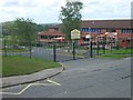
Milking Bank Primary School
The School off Aintree Way.
Image: © Gordon Griffiths
Taken: 20 Aug 2008
0.06 miles
2
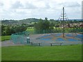
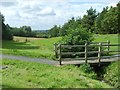
Milking Bank Playpark
The View towards Barrow Hill.
Image: © Gordon Griffiths
Taken: 21 Aug 2008
0.08 miles
7
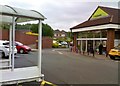
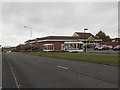
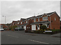
Co-op View
The local Co-op at Milking Bank, Dudley.
Image: © Gordon Griffiths
Taken: 10 Jun 2017
0.19 miles
8
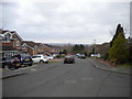
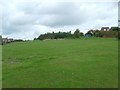
Osberton Drive, Milking Bank (2)
Looking towards the distant hills in Shropshire, which can be seen from this side of Dudley on a reasonably clear day.
Image: © Richard Vince
Taken: 2 Mar 2019
0.19 miles
10
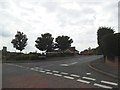
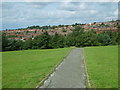
Dibdale Road West
The view of the road junction in Dudley.
Image: © Gordon Griffiths
Taken: 18 Jun 2016
0.20 miles