IMAGES TAKEN NEAR TO
The Oval, DUDLEY, DY1 2LN
Introduction
This page details the photographs taken nearby to The Oval, DY1 2LN by members of the Geograph project.
The Geograph project started in 2005 with the aim of publishing, organising and preserving representative images for every square kilometre of Great Britain, Ireland and the Isle of Man.

There are currently over 7.5m images from over14,400 individuals and you can help contribute to the project by visiting https://www.geograph.org.uk
Image Map
Images are licensed for reuse under creativecommons.org/licenses/by-sa/2.0
Notes
- Clicking on the map will re-center to the selected point.
- The higher the marker number, the further away the image location is from the centre of the postcode.
Image Listing (16 Images Found)
Images are licensed for reuse under creativecommons.org/licenses/by-sa/2.0
Image
Details
Distance
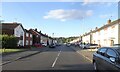
1
Quentin Drive
The view from Ashenhurst Road on the Russell's Hall Estate in Dudley.
Image: © Gordon Griffiths
Taken: 20 Sep 2022
0.09 miles
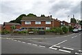
2
Russell's Hall View
The view across Overfield Road on the Russell's Hall Estate, Dudley.
Image: © Gordon Griffiths
Taken: 11 Apr 2015
0.15 miles
3
Bus Stop View
The view down Overfield Road on the Russell's Hall Estate, Dudley.
Image: © Gordon Griffiths
Taken: 11 Apr 2015
0.16 miles
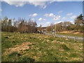
4
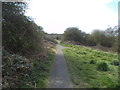
Estate Path
The view along the path off Overfield Road on the Russell's Hall Estate, Dudley.
Image: © Gordon Griffiths
Taken: 11 Apr 2015
0.17 miles
5
Middlepark Road
The view in Russsell's Hall Estate, Dudley.
Image: © Gordon Griffiths
Taken: 6 Aug 2024
0.17 miles
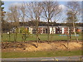
6
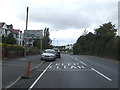
Pensett Road, Holly Hall, Dudley
Approaching roundabout.
Image: © JThomas
Taken: 22 Aug 2019
0.22 miles
7
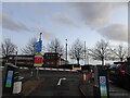
Hospital Car Park
The view of Russells Hall Hospital in Dudley Town.
Image: © Gordon Griffiths
Taken: 20 Oct 2024
0.22 miles
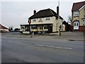
9
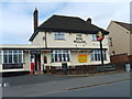
The King William
A Pub on the Pensnett Road.
Image: © Gordon Griffiths
Taken: 9 Apr 2007
0.23 miles