IMAGES TAKEN NEAR TO
Stourbridge Road, DUDLEY, DY1 2DH
Introduction
This page details the photographs taken nearby to Stourbridge Road, DY1 2DH by members of the Geograph project.
The Geograph project started in 2005 with the aim of publishing, organising and preserving representative images for every square kilometre of Great Britain, Ireland and the Isle of Man.

There are currently over 7.5m images from over14,400 individuals and you can help contribute to the project by visiting https://www.geograph.org.uk
Image Map
Images are licensed for reuse under creativecommons.org/licenses/by-sa/2.0
Notes
- Clicking on the map will re-center to the selected point.
- The higher the marker number, the further away the image location is from the centre of the postcode.
Image Listing (32 Images Found)
Images are licensed for reuse under creativecommons.org/licenses/by-sa/2.0
Image
Details
Distance
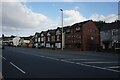
3
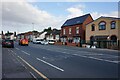
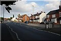
Dudley : Stourbridge Road A4101
Looking along Stourbridge Road.
Image: © Lewis Clarke
Taken: 27 Sep 2019
0.04 miles
4
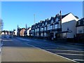
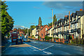
Stourbridge Road View
The view up the A4101 road towards Dudley Town.
Image: © Gordon Griffiths
Taken: 7 Jan 2018
0.05 miles
9
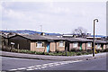
'Prefabs' on Holly Hall Road, Dudley in 1977
Prefabs - prefabricated homes - such as these were built in large numbers in the post-WWII period as a temporary answer to the housing shortage; they had an expected life of around 10 years. Those in the image were still in place in 1977 and they presumably lasted longer. The nearest building is / was at the junction of Clee Road and Holly Hall Road. The A461 dual carriageway now slices through the location though both roads still exist according to current mapping, in 2020.
Image: © Trevor Littlewood
Taken: 8 Apr 1977
0.13 miles