
IMAGES TAKEN NEAR TO
Dowles Road, BEWDLEY, DY12 2RA
Introduction
This page details the photographs taken nearby to Dowles Road, DY12 2RA by members of the Geograph project.
The Geograph project started in 2005 with the aim of publishing, organising and preserving representative images for every square kilometre of Great Britain, Ireland and the Isle of Man.

There are currently over 7.5m images from over14,400 individuals and you can help contribute to the project by visiting https://www.geograph.org.uk
Image Map
Images are licensed for reuse under creativecommons.org/licenses/by-sa/2.0
Notes
- Clicking on the map will re-center to the selected point.
- The higher the marker number, the further away the image location is from the centre of the postcode.
Image Listing (196 Images Found)
Images are licensed for reuse under creativecommons.org/licenses/by-sa/2.0
Image
Details
Distance
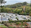
2
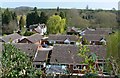
Sabrina Drive, Bewdley
Viewed from Dowles Road.
Image: © Mat Fascione
Taken: 8 Apr 2007
0.05 miles
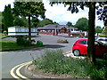
4
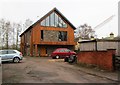
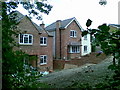
Modern house, Greenacres Lane, Bewdley, Worcs
An attractive modern house completed in the last year or two. Photographed from the public footpath running along Greenacres Lane.
Image
Image: © P L Chadwick
Taken: 23 Jan 2016
0.12 miles
5

Riverside Meadows (town side), Bewdley
The bungalows in the distance are in Sabrina Drive.
Image
Image: © P L Chadwick
Taken: 9 Jul 2011
0.12 miles
6
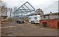
Frame of new building under construction off Greenacres Lane, Bewdley, Worcs
A new two-storey building is under construction here, possibly a house. So far only a metal frame has been erected. Photographed from the public footpath running along Greenacres Lane.
The completed building:- Image
Image: © P L Chadwick
Taken: 1 Dec 2013
0.12 miles
7
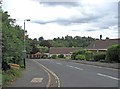
Sabrina Drive
The start of Sabrina Drive, which is a turning off Dowles Road (the B4194). It is a post-World War II residential road. The name derives from the Roman name Sabrina for the local river, which in England we call today the Severn. The name Sabrina was latinised from the Old Welsh name Habren. From the name Habren came the modern Welsh name for the river of Hafryn.
The naming of this road gave rise to some local controversy at the time:- Image
Image: © P L Chadwick
Taken: 19 Aug 2010
0.12 miles
9
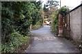
Start of Greenacres Lane near the riverside, Bewdley, Worcs
Greenacres Lane is a private drive running from the riverside up to and through the Riverside Caravan Park, and coming out on the B4194 road on the other side. It also gives access to other properties. There is a public footpath running along the whole of the drive between here and the B4194 road.
Image: © P L Chadwick
Taken: 1 Dec 2013
0.12 miles
10
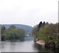
River Severn, upstream from Bewdley
The view upstream (north) from Bewdley Bridge.
Image: © Andy F
Taken: 12 Apr 2009
0.12 miles