IMAGES TAKEN NEAR TO
Elan Close, BEWDLEY, DY12 2PR
Introduction
This page details the photographs taken nearby to Elan Close, DY12 2PR by members of the Geograph project.
The Geograph project started in 2005 with the aim of publishing, organising and preserving representative images for every square kilometre of Great Britain, Ireland and the Isle of Man.

There are currently over 7.5m images from over14,400 individuals and you can help contribute to the project by visiting https://www.geograph.org.uk
Image Map (Loading...)


Getting Data...Please wait
Leaflet Map data © OpenStreetMap
Images are licensed for reuse under creativecommons.org/licenses/by-sa/2.0
Notes
- Clicking on the map will re-center to the selected point.
- The higher the marker number, the further away the image location is from the centre of the postcode.
Image Listing (12 Images Found)
Images are licensed for reuse under creativecommons.org/licenses/by-sa/2.0
Image
Details
Distance
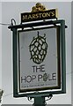
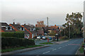
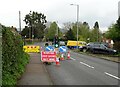
1
B4190 Cleobury Road, Hales Park, Bewdley
Image: © Roy Hughes
Taken: 25 Jun 2020
0.12 miles
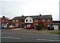
4
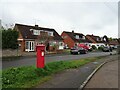
Houses on Cleobury Road, Bewdley
Showing position of Postbox No. Dy12 125.
See Image] for postbox.
Image: © JThomas
Taken: 17 Apr 2023
0.17 miles
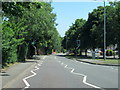
6
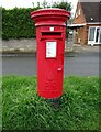
Elizabeth II postbox on Cleobury Road, Bewdley
Postbox No. DY12 125.
See Image] for context.
Image: © JThomas
Taken: 17 Apr 2023
0.18 miles
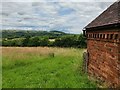
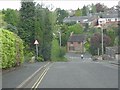
8
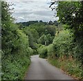
Tanner's Hill at Bewdley
This lane leads to Ruskin Land in the Wyre Forest.
Image: © Mat Fascione
Taken: 5 Jul 2023
0.23 miles