
IMAGES TAKEN NEAR TO
Severnside South, BEWDLEY, DY12 2DS
Introduction
This page details the photographs taken nearby to Severnside South, DY12 2DS by members of the Geograph project.
The Geograph project started in 2005 with the aim of publishing, organising and preserving representative images for every square kilometre of Great Britain, Ireland and the Isle of Man.

There are currently over 7.5m images from over14,400 individuals and you can help contribute to the project by visiting https://www.geograph.org.uk
Image Map
Images are licensed for reuse under creativecommons.org/licenses/by-sa/2.0
Notes
- Clicking on the map will re-center to the selected point.
- The higher the marker number, the further away the image location is from the centre of the postcode.
Image Listing (1015 Images Found)
Images are licensed for reuse under creativecommons.org/licenses/by-sa/2.0
Image
Details
Distance
1

Severnside South and the River Severn
Looking away from the town centre in this view. Along this part of the road the Council have constructed a "mini-promenade" with seats and a litter bin.
Image: © P L Chadwick
Taken: 14 Sep 2008
0.01 miles
2

Old Tannery Court, Bewdley, Worcs
Old Tannery Court is a modern housing development of apartments. The car park is for residents only and is accessed from Severn Side South through an arch. The footpath on the right leads from Severn Side South to Queen Elizabeth II Gardens.
Image
Image: © P L Chadwick
Taken: 18 Mar 2023
0.01 miles
3
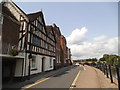
Severn Side South
The view down the river side street in Bewdley.
Image: © Gordon Griffiths
Taken: 26 Jun 2013
0.02 miles
4
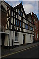
27 Severnside, Bewdley
Timber-framed house on Severnside overlooking the River Severn in Bewdley.
Image: © Philip Halling
Taken: 1 Nov 2008
0.02 miles
5
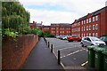
Footpath to Severnside South from Queen Elizabeth II Jubilee Gardens, Bewdley, Worcs
The footpath runs to the left of the bollards and passes under the arch, in the distance, and then connects with Severnside South. Also known as Severn Side South. The multi-storey buildings are apartment blocks.
Image
Image
Image: © P L Chadwick
Taken: 19 Sep 2022
0.02 miles

7
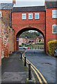
Archway, Old Tannery Court, Bewdley, Worcs
The other side of the arch is Severn Side South and the River Severn. The footpath on the left runs between Queen Elizabeth II Gardens and Severn Side South.
Image
Image: © P L Chadwick
Taken: 18 Mar 2023
0.02 miles
8

Footpath to exit to Severnside South, Queen Elizabeth II Gardens, Bewdley, Worcs
This footpath leads to a gate (open in this photograph). The footpath then continues past apartment blocks and after passing under an arch it comes out on Severnside South (also spelt Severn Side South).
Image: © P L Chadwick
Taken: 19 Sep 2022
0.03 miles
9
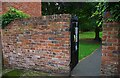
Entrance gate from Severnside South to Queen Elizabeth II Jubilee Gardens, Bewdley, Worcs
See also:- Image
Image: © P L Chadwick
Taken: 19 Sep 2022
0.03 miles
10

Severnside South
Looking away from the town centre. The road is now one-way and the pavement on the left has been widened.
Image: © P L Chadwick
Taken: 14 Sep 2008
0.03 miles