
IMAGES TAKEN NEAR TO
Upper Arley, BEWDLEY, DY12 1XA
Introduction
This page details the photographs taken nearby to Upper Arley, DY12 1XA by members of the Geograph project.
The Geograph project started in 2005 with the aim of publishing, organising and preserving representative images for every square kilometre of Great Britain, Ireland and the Isle of Man.

There are currently over 7.5m images from over14,400 individuals and you can help contribute to the project by visiting https://www.geograph.org.uk
Image Map
Images are licensed for reuse under creativecommons.org/licenses/by-sa/2.0
Notes
- Clicking on the map will re-center to the selected point.
- The higher the marker number, the further away the image location is from the centre of the postcode.
Image Listing (858 Images Found)
Images are licensed for reuse under creativecommons.org/licenses/by-sa/2.0
Image
Details
Distance
1
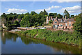
River Severn at Upper Arley in Worcestershire
Viewed from the footbridge crossing the river, looking north-west.
Image: © Roger Kidd
Taken: 20 Sep 2021
0.00 miles
2
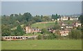
Upper Arley
The small settlement beside the River Severn, viewed from north of the railway station, looking across the river.
Image: © Rob Newman
Taken: 27 Sep 2008
0.01 miles
4
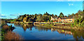
Upper Arley
From the footbridge on a perfect Winter's day
Image: © Philip Pankhurst
Taken: 27 Dec 2017
0.02 miles
5

View across the River Severn to Upper Arley, Worcs
This part of the River is only negotiable by canoes and the like. The official head of navigation is just a short distance west of the bridge at Stourport-on-Severn.
Image: © P L Chadwick
Taken: 15 Apr 2021
0.02 miles
6
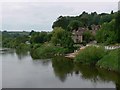
Upper Arley and River Severn
The view from the footbridge, with the slipway from the former ferry.
Image: © Wim Kegel
Taken: 3 Jun 2007
0.02 miles
7
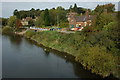
Upper Arley
Upper Arley viewed from the footbridge over the River Severn.
Image: © Philip Halling
Taken: 17 Oct 2009
0.02 miles
8
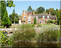
Housing in Arley Lane, Upper Arley, Worcestershire
This is a telephoto assisted image looking north across the River Severn, west of the footbridge.
Image: © Roger D Kidd
Taken: 28 Sep 2011
0.02 miles
9
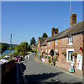
Arley Lane at Upper Arley, Worcestershire
The village shop and post office are on the right.
Image: © Roger D Kidd
Taken: 28 Sep 2011
0.02 miles
10
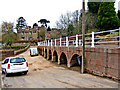
Upper Arley village road on embankment
The unclassified road which serves the small village of Upper Arley is carried along a raised embankment at this point where it passes the small harbour. Today the village is in Worcestershire but a long time ago it was actually in Staffordshire.
Image: © P L Chadwick
Taken: 23 Feb 2008
0.02 miles