IMAGES TAKEN NEAR TO
Severn Grove, KIDDERMINSTER, DY11 7NT

Introduction

This page details the photographs taken nearby to Severn Grove, DY11 7NT by members of the Geograph project.

The Geograph project started in 2005 with the aim of publishing, organising and preserving representative images for every square kilometre of Great Britain, Ireland and the Isle of Man.

There are currently over 7.5m images from over14,400 individuals and you can help contribute to the project by visiting https://www.geograph.org.uk

Image Map


Images are licensed for reuse under creativecommons.org/licenses/by-sa/2.0
Notes
  • Clicking on the map will re-center to the selected point.
  • The higher the marker number, the further away the image location is from the centre of the postcode.

Image Listing (16 Images Found)

Images are licensed for reuse under creativecommons.org/licenses/by-sa/2.0
Image
Details
Distance
1
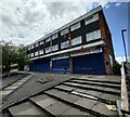
Closed shops on Severn Grove, Kidderminster
Image: © Mat Fascione Taken: 21 Jun 2023
0.02 miles
2
The Musketeer, Avon Road, Kidderminster
This is the estate pub for the Rifle Range Estate. The pub also has an off-licence.
Image: © P L Chadwick Taken: 11 Jan 2009
0.05 miles
3
Jubilee Drive North in Kidderminster
Image: © Mat Fascione Taken: 21 Jun 2023
0.10 miles
4
Entrance to the Rifle Range Nature Reserve
At the end of Rifle Range Road.
Image: © Mat Fascione Taken: 4 Jan 2023
0.14 miles
5
Tarmac track to the Rifle Range Nature Reserve
Image: © Mat Fascione Taken: 21 Jun 2023
0.15 miles
6
Sutton Park Road at Goldthorn Road
Image: © Peter Whatley Taken: 26 Oct 2011
0.18 miles
7
Site of the demolished Sutton Arms pub, 195 Sutton Park Road, Kidderminster
The pub had been under threat for a long time. By September 2010, it was virtually all demolished, although the pub's sign, attached to a post, was still standing. As so often happens, the large site will be used for yet more housing, leaving this part of the town with very few facilities. Some more pictures:- Image Image Image The pub when still open:- Image
Image: © P L Chadwick Taken: 15 Sep 2010
0.20 miles
8
Another Kidderminster pub bites the dust
All that remains of The Sutton Arms, is a small section of wall, which can be seen still standing, and the pub's sign, which remains attached to its post. The houses in the distance are in Parry Road. The site is due to be used for building new houses. Photographed from the pavement in Sutton Park Road. Links to more pictures, past and present:- Image
Image: © P L Chadwick Taken: 15 Sep 2010
0.20 miles
9
Sign of the demolished Sutton Arms pub, 195 Sutton Park Road, Kidderminster
Rather surprisingly, the pub sign, on its post, remains within the site perimeter fence. The site of the demolished pub, and its car park, occupies a large area, on which houses are to be built. One can guess that the development will be called Sutton Arms Court, or similar. It seems unlikely that the sign will remain, as the new occupiers could then expect the occasional knock on the door from someone demanding alcohol. Links to more pictures, past and present:- Image
Image: © P L Chadwick Taken: 15 Sep 2010
0.20 miles
10
The Sutton Arms, 195 Sutton Park Road, Kidderminster
A huge estate pub serving the Sutton Park area of Kidderminster. It has live music, and a function room which can accommodate 100 people. It is still labelled Banks, although following a series of mergers the company became known as Marston's in 2007. The long-term future of the pub is uncertain. It was put up for sale by Marston's and later withdrawn from the market. The brewery obtained outline planning permission in March 2009 to demolish the pub, and replace it with between 11 and 14 residential dwellings. The pub is on a large site, with lots of car parking, so there is plenty of space available. There is a limited time period in which the matter can be proceeded with, but currently (December 2009) the pub is still trading. For another view:- Image Update October 2010:- Sadly the pub has now been demolished, and will be replaced with housing. See:- Image
Image: © P L Chadwick Taken: 9 Dec 2009
0.21 miles