
IMAGES TAKEN NEAR TO
Finepoint Way, KIDDERMINSTER, DY11 7FE
Introduction
This page details the photographs taken nearby to Finepoint Way, DY11 7FE by members of the Geograph project.
The Geograph project started in 2005 with the aim of publishing, organising and preserving representative images for every square kilometre of Great Britain, Ireland and the Isle of Man.

There are currently over 7.5m images from over14,400 individuals and you can help contribute to the project by visiting https://www.geograph.org.uk
Image Map
Images are licensed for reuse under creativecommons.org/licenses/by-sa/2.0
Notes
- Clicking on the map will re-center to the selected point.
- The higher the marker number, the further away the image location is from the centre of the postcode.
Image Listing (43 Images Found)
Images are licensed for reuse under creativecommons.org/licenses/by-sa/2.0
Image
Details
Distance
1
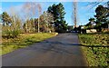
Access road to former Burlish Park Golf Club, Zortech Avenue, Kidderminster, Worcs
This is the access road to the former golf club, looking towards the entrance at the end of Zortech Avenue.
Image: © P L Chadwick
Taken: 16 Jan 2021
0.08 miles
2

Gilt Edge
The view of the club off Zortech Avenue in Kidderminster, Worcestershire.
Image: © Gordon Griffiths
Taken: 13 Sep 2023
0.09 miles
3
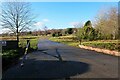
Access road to former Burlish Park Golf Course, Zortech Avenue, Kidderminster, Worcs
This is the start of the access road to the former Burlish Park Golf Club. Just behind the camera position is Zortech Avenue, of which the access road is a continuation.
Image: © P L Chadwick
Taken: 16 Jan 2021
0.10 miles
4
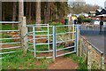
Entrance to Vicarage Farm Heath, Walter Nash Road West, Kidderminster, Worcs
The entrance to this nature reserve from Water Nash Road West is through this kissing gate. There are other entrances to the reserve.
Image
Image: © P L Chadwick
Taken: 6 Mar 2021
0.10 miles
5
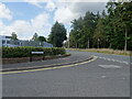
Zortech Avenue View
The view up Walter Nash Road West in Kidderminster, Worcs.
Image: © Gordon Griffiths
Taken: 13 Sep 2023
0.10 miles
6
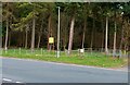
Vicarage Farm Heath, Walter Nash Road West, Kidderminster, Worcs
This nature reserve was opened in December 2002 but doesn't seem to be very well known. Perhaps that is not a bad thing as previously it was used to dump abandoned cars, and other anti-social practices. Today it is an attractive place to visit. It consists of pine woodland and lowland heath. Extending to eleven hectares (27 acres), it is home to insects including bee wolves, which are rare wasps that hunt bees. There are several entrances to the reserve.
Image: © P L Chadwick
Taken: 6 Mar 2021
0.10 miles
7
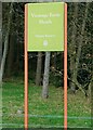
Vicarage Farm Heath - sign, Walter Nash Road West, Kidderminster, Worcs
White lettering on a light green background doesn't make for very legible signs. But that was the choice here, on this sign for Wyre Forest District Council's nature reserve.
Image
Image: © P L Chadwick
Taken: 6 Mar 2021
0.11 miles
8

Gilt Edge Bowling Green
The view of the club off Zortech Avenue in Kidderminster, Worcestershire.
Image: © Gordon Griffiths
Taken: 13 Sep 2023
0.11 miles
9
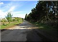
Track leading to Zortech Avenue, Kidderminster
The track is heading for the end of Zortech Avenue. On the left is Burlish Park Golf Course.
Image: © P L Chadwick
Taken: 11 Apr 2014
0.11 miles
10

New gate and kissing gate on former Burlish Top Golf Course, Kidderminster, Worcs
A new fence has been installed to prevent cattle wandering off the former golf course. This gate and kissing gate allow cattle to be moved on and off the former golf course and the public to enter and leave the area. The former golf course straddled the boundary between the towns of Kidderminster and Stourport-on-Severn. The fence and the gates are in Kidderminster. See:- Image
Image: © P L Chadwick
Taken: 16 Jan 2021
0.11 miles