
IMAGES TAKEN NEAR TO
Stourport Road, KIDDERMINSTER, DY11 7BA
Introduction
This page details the photographs taken nearby to Stourport Road, DY11 7BA by members of the Geograph project.
The Geograph project started in 2005 with the aim of publishing, organising and preserving representative images for every square kilometre of Great Britain, Ireland and the Isle of Man.

There are currently over 7.5m images from over14,400 individuals and you can help contribute to the project by visiting https://www.geograph.org.uk
Image Map
Images are licensed for reuse under creativecommons.org/licenses/by-sa/2.0
Notes
- Clicking on the map will re-center to the selected point.
- The higher the marker number, the further away the image location is from the centre of the postcode.
Image Listing (228 Images Found)
Images are licensed for reuse under creativecommons.org/licenses/by-sa/2.0
Image
Details
Distance
1
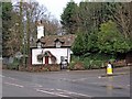
Old cottage, Kidderminster
An attractive residence on Stourport Road, with an unusual chimney, which contrasts with most of the housing along this road, which is fairly undistinguished.
Image: © P L Chadwick
Taken: 27 Feb 2011
0.02 miles
2
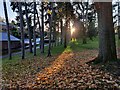
Trees along the southern edge of Brinton Park
Image: © Mat Fascione
Taken: 15 Nov 2020
0.02 miles
4
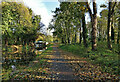
Staffordshire and Worcestershire Canal in Kidderminster
Round Hill Bridge No 13 in the distance.
Image: © Mat Fascione
Taken: 2 Nov 2020
0.05 miles
5
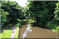
Staffordshire & Worcestershire Canal, Kidderminster
Photographed from the bridge taking Stourport Road (the A451) across the canal.
Image: © P L Chadwick
Taken: 14 Jul 2012
0.05 miles
6
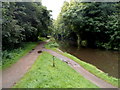
A canal cycle route, Kidderminster
A small wooden sign in a grass triangle shows National Cycle Network route 54.
Viewed from the edge of Round Hill Bridge http://www.geograph.org.uk/photo/3335965 looking SSW along the Staffordshire & Worcestershire Canal.
Image: © Jaggery
Taken: 22 Sep 2012
0.05 miles
7
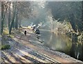
Narrowboats moored along the Staffordshire and Worcestershire Canal
Viewed from Round Hill Bridge.
Image: © Mat Fascione
Taken: 16 Dec 2022
0.05 miles
8
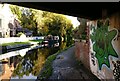
Round Hill Bridge No 13
Next to the Watermill pub on the Staffordshire and Worcestershire Canal.
Image: © Mat Fascione
Taken: 2 Nov 2020
0.05 miles
9
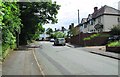
Larches Road, Kidderminster
A residential road which ascends quite steeply from its junction with Stourport Road (the A451).
Image: © P L Chadwick
Taken: 8 Jun 2014
0.05 miles
10
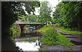
Watermill Bridge, Staffs & Worcs Canal, Kidderminster
The bridge takes Stourport Road (the A451) across the canal. The other side of the bridge is the Watermill, a public house and restaurant.
Image: © P L Chadwick
Taken: 14 Jul 2012
0.05 miles