IMAGES TAKEN NEAR TO
Quayle Court, KIDDERMINSTER, DY11 6SQ
Introduction
This page details the photographs taken nearby to Quayle Court, DY11 6SQ by members of the Geograph project.
The Geograph project started in 2005 with the aim of publishing, organising and preserving representative images for every square kilometre of Great Britain, Ireland and the Isle of Man.

There are currently over 7.5m images from over14,400 individuals and you can help contribute to the project by visiting https://www.geograph.org.uk
Image Map
Images are licensed for reuse under creativecommons.org/licenses/by-sa/2.0
Notes
- Clicking on the map will re-center to the selected point.
- The higher the marker number, the further away the image location is from the centre of the postcode.
Image Listing (78 Images Found)
Images are licensed for reuse under creativecommons.org/licenses/by-sa/2.0
Image
Details
Distance
1

Kidderminster Treatment Centre - boiler house
Contains three FKI Babcock Robey dual fuelled single burner, three pass packaged boilers exhausting up a substantial concrete chimney. The silver vessel just in front is the blowdown receiver for flashing off the blowdown water. I think it also flashes off steam from the gauge glass assemblies as they need to be tested regularly and that involves releasing water/steam under pressure.
Image: © Chris Allen
Taken: 27 Jun 2014
0.06 miles
2

Kidderminster Treatment Centre
This was once a fully fledged district general hospital serving the Wyre Forest but has been downgraded to a treatment centre and minor injuries unit although still comprising a very substantial estate that is not fully encompassed in this view. A major political battle was fought over this and Dr Richard Taylor a former consultant physician was elected as an independent member of parliament on a save our hospital ticket. He was so popular he was elected for a second term even when the original reason was gone.
Image: © Chris Allen
Taken: 27 Jun 2014
0.07 miles
4
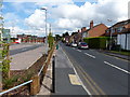
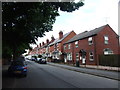
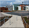
Hume Street in Kidderminster
On the left is Kidderminster Hospital.
Image: © Mat Fascione
Taken: 28 Jul 2013
0.09 miles

6
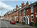
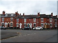
Cobden Street, Kidderminster
A row of terraced houses that were probably occupied by workers in the town's many carpet factories.
Image: © Chris Allen
Taken: 17 Jul 2015
0.09 miles
9
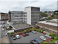
Kidderminster Treatment Centre
This was once one of three district general hospitals in Worcestershire but has now been downgraded to a treatment centre and minor injuries unit. Nonetheless there is still a substantial estate. The building left background is a new health centre that has been built on a demolished part of the hospital.
Image: © Chris Allen
Taken: 17 Jul 2015
0.09 miles