IMAGES TAKEN NEAR TO
Waggon Lane, KIDDERMINSTER, DY10 3PN
Introduction
This page details the photographs taken nearby to Waggon Lane, DY10 3PN by members of the Geograph project.
The Geograph project started in 2005 with the aim of publishing, organising and preserving representative images for every square kilometre of Great Britain, Ireland and the Isle of Man.

There are currently over 7.5m images from over14,400 individuals and you can help contribute to the project by visiting https://www.geograph.org.uk
Image Map
Images are licensed for reuse under creativecommons.org/licenses/by-sa/2.0
Notes
- Clicking on the map will re-center to the selected point.
- The higher the marker number, the further away the image location is from the centre of the postcode.
Image Listing (15 Images Found)
Images are licensed for reuse under creativecommons.org/licenses/by-sa/2.0
Image
Details
Distance
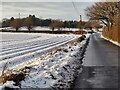
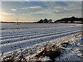
5
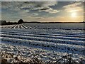
Snow covered farmland next to Waggon Lane
Image: © Mat Fascione
Taken: 30 Dec 2020
0.10 miles
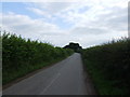
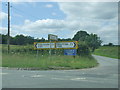
6
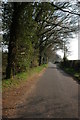
Waggon Lane
Waggon Lane goes to Churchill.
Image: © Philip Halling
Taken: 31 Mar 2007
0.10 miles
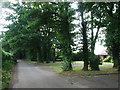
7
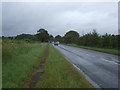
A451 towards Stourbridge
Looking north east.
Image: © JThomas
Taken: 8 Jun 2019
0.10 miles
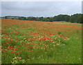
9
Snow covered farmland next to Waggon Lane
Image: © Mat Fascione
Taken: 30 Dec 2020
0.13 miles
10
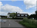
A451 Stourbridge Road
At the crossroads with Axborough Lane and Waggon Lane.
Image: © Chris Whippet
Taken: 19 Jun 2010
0.15 miles