
IMAGES TAKEN NEAR TO
Tabbs Gardens, KIDDERMINSTER, DY10 2DT
Introduction
This page details the photographs taken nearby to Tabbs Gardens, DY10 2DT by members of the Geograph project.
The Geograph project started in 2005 with the aim of publishing, organising and preserving representative images for every square kilometre of Great Britain, Ireland and the Isle of Man.

There are currently over 7.5m images from over14,400 individuals and you can help contribute to the project by visiting https://www.geograph.org.uk
Image Map
Images are licensed for reuse under creativecommons.org/licenses/by-sa/2.0
Notes
- Clicking on the map will re-center to the selected point.
- The higher the marker number, the further away the image location is from the centre of the postcode.
Image Listing (46 Images Found)
Images are licensed for reuse under creativecommons.org/licenses/by-sa/2.0
Image
Details
Distance
1
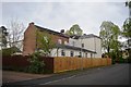
The Shrubbery - Birmingham Road (rear)
The 19th Century house now used as a nursing home is a Grade II listed building. For many years until the mid 1990s this had been adapted for military use with offices and drill hall. At the outbreak of the Great War it was the base for A Squadron, Worcestershire Yeomanry and the base and HQ for 7th Battalion, Worcestershire Regiment. The current 4th Battalion, Mercian Regiment has a new building adjacent.
Image: © John M
Taken: 27 Apr 2014
0.07 miles
3
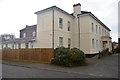
The Shrubbery - Birmingham Road (front and side)
The 19th Century house now used as a nursing home is a Grade II listed building. For many years until the mid 1990s this had been adapted for military use with offices and drill hall. At the outbreak of the Great War it was the base for A Squadron, Worcestershire Yeomanry and the base and HQ for 7th Battalion, Worcestershire Regiment. The current 4th Battalion, Mercian Regiment has a new building adjacent.
Image: © John M
Taken: 27 Apr 2014
0.08 miles
4
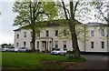
The Shrubbery - Birmingham Road
The 19th Century house now used as a nursing home is a Grade II listed building. For many years until the mid 1990s this had been adapted for military use with offices and drill hall. At the outbreak of the Great War it was the base for A Squadron, Worcestershire Yeomanry and the base and HQ for 7th Battalion, Worcestershire Regiment. The current 4th Battalion, Mercian Regiment has a new building adjacent.
Image: © John M
Taken: 27 Apr 2014
0.08 miles
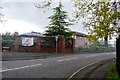
6
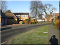
Trinity Fields, Kidderminster
A mixed development of housing close to the town's centre. The two-storey building middle-left is a school.
Image: © Peter Whatley
Taken: 3 Jan 2009
0.09 miles
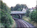
8
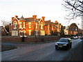
Shrubbery Road meets Birmingham Road, Kidderminster
Image: © Peter Whatley
Taken: 3 Jan 2009
0.11 miles
10

King George VI wall-mounted postbox, Roden Avenue
Placed here sometime between 1937 and 1952, this box has been repainted so many times that the cypher and lettering have lost their original sharpness.
Image: © P L Chadwick
Taken: 24 Jan 2010
0.11 miles