IMAGES TAKEN NEAR TO
Gifle View, SHERBORNE, DT9 6SS
Introduction
This page details the photographs taken nearby to Gifle View, DT9 6SS by members of the Geograph project.
The Geograph project started in 2005 with the aim of publishing, organising and preserving representative images for every square kilometre of Great Britain, Ireland and the Isle of Man.

There are currently over 7.5m images from over14,400 individuals and you can help contribute to the project by visiting https://www.geograph.org.uk
Image Map (Loading...)


Getting Data...Please wait
Leaflet Map data © OpenStreetMap
Images are licensed for reuse under creativecommons.org/licenses/by-sa/2.0
Notes
- Clicking on the map will re-center to the selected point.
- The higher the marker number, the further away the image location is from the centre of the postcode.
Image Listing (88 Images Found)
Images are licensed for reuse under creativecommons.org/licenses/by-sa/2.0
Image
Details
Distance
1
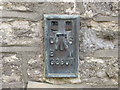
Ordnance Survey Flush Bracket G3907
This can be found on the wall of a house in Thornford Lane.
For more detail see : http://www.bench-marks.org.uk/bm15938
Image: © Peter Wood
Taken: 31 Mar 2014
0.15 miles
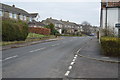
4
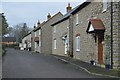
House by the churchyard, Thornford
Image: © Jonathan Thacker
Taken: 14 Sep 2017
0.19 miles
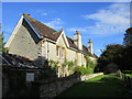
7

St. Mary Magdalene, Thornford: artwork (B)
Image: © Basher Eyre
Taken: 7 Sep 2012
0.19 miles
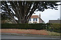
8
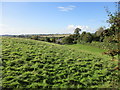
Bembury Farm, Thornford
Seen from the churchyard.
Image: © Jonathan Thacker
Taken: 14 Sep 2017
0.19 miles
10
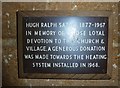
St. Mary Magdalene, Thornford: memorial (i)
Image: © Basher Eyre
Taken: 7 Sep 2012
0.20 miles