
IMAGES TAKEN NEAR TO
Stoke Abbott, BEAMINSTER, DT8 3JR
Introduction
This page details the photographs taken nearby to DT8 3JR by members of the Geograph project.
The Geograph project started in 2005 with the aim of publishing, organising and preserving representative images for every square kilometre of Great Britain, Ireland and the Isle of Man.

There are currently over 7.5m images from over14,400 individuals and you can help contribute to the project by visiting https://www.geograph.org.uk
Image Map
Images are licensed for reuse under creativecommons.org/licenses/by-sa/2.0
Notes
- Clicking on the map will re-center to the selected point.
- The higher the marker number, the further away the image location is from the centre of the postcode.
Image Listing (94 Images Found)
Images are licensed for reuse under creativecommons.org/licenses/by-sa/2.0
Image
Details
Distance
1
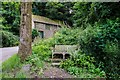
Stoke Abbott: Oak Tree Commemorating King Edward VII
The picture shows the trunk of this oak tree planted at the start of the King's reign in 1901. A plaque with these details can be seen at the base.
Image: © Mr Eugene Birchall
Taken: 18 Jun 2012
0.03 miles
2
Cat ignores 'road closed' sign, on Norway Lane
Image: © Roger Cornfoot
Taken: 24 Dec 2020
0.03 miles
3
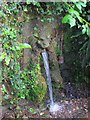
Lion's head water spout and drinking cup, Stoke Abbott
This water fountain was built to celebrate Queen Elizabeth II's coronation in 1953. It replaced a much older one. I'm not sure if anyone still uses the cup to drink from it!
Image: © Becky Williamson
Taken: 5 Aug 2016
0.04 miles
7
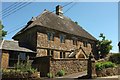
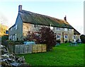
Court Orchard, Stoke Abbott
This fine C18 farmhouse is grade II* listed https://www.historicengland.org.uk/listing/the-list/list-entry/1287140 . The description mentions two dates inscribed on the building, 1751 and 1762, and Newman and Pevsner's comment on the mullioned windows is "reactionary" http://www.worldcat.org/title/the-buildings-of-england-dorset-by-john-newman-and-nikolaus-pevsner-7-4-pp-554-103-pls-harmondsworth-penguin-books-ltd-1972-250-either-issn-or-journal-title-must-be-supplied/oclc/4814466353&referer=brief_results ; we're obviously in deepest backward-looking Dorset here, or were 260 years ago.
Image: © Derek Harper
Taken: 26 May 2017
0.06 miles
8
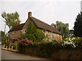
Stoke Abbott: New Inn
An attractive thatched pub.
Image: © Chris Downer
Taken: 2 Jul 2009
0.06 miles
9

The Orange Way in Dorset and Somerset (50)
This is the sign at the "New Inn" in Stoke Abbott. The sign has been changed since the submission at http://www.geograph.org.uk/photo/1114935.
To proceed to the next section of the Orange Way go to www.geograph.org.uk/geotrips/433.
Image: © Shazz
Taken: 1 Jul 2012
0.07 miles
10

Stoke Abbott: The Anchor
This house stands opposite the Image and, given its name (according to large-scale maps), it may also once have been a public house.
Image: © Chris Downer
Taken: 2 Jul 2009
0.07 miles