IMAGES TAKEN NEAR TO
Whitchurch Canonicorum, BRIDPORT, DT6 6RL
Introduction
This page details the photographs taken nearby to DT6 6RL by members of the Geograph project.
The Geograph project started in 2005 with the aim of publishing, organising and preserving representative images for every square kilometre of Great Britain, Ireland and the Isle of Man.

There are currently over 7.5m images from over14,400 individuals and you can help contribute to the project by visiting https://www.geograph.org.uk
Image Map
Images are licensed for reuse under creativecommons.org/licenses/by-sa/2.0
Notes
- Clicking on the map will re-center to the selected point.
- The higher the marker number, the further away the image location is from the centre of the postcode.
Image Listing (10 Images Found)
Images are licensed for reuse under creativecommons.org/licenses/by-sa/2.0
Image
Details
Distance
2
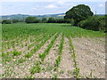
Maize Field at Purcombe Farm
This field is just to the south of the lane leading to Purcombe Farm. Its is on the gently sloping flood plain that leads down to the River Char which is just beyond the pylons in the distance. The crop in this part of the field was rather stunted due to the recent hot dry weather.
Image: © Nigel Mykura
Taken: 12 Jul 2014
0.07 miles
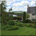
3
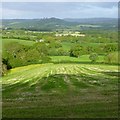
Looking down the lower slopes of Coppet Hill
Image: © David Lally
Taken: 19 May 2015
0.13 miles
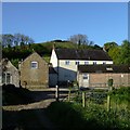
4
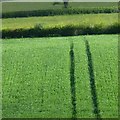
Grass field
Nearly ready for cutting for silage.
Image: © David Lally
Taken: 20 May 2015
0.13 miles
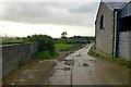
6
Purcombe Farm
From the BOAT (Stoke Mill Lane) to the north of the farm.
Image: © Becky Williamson
Taken: 27 Jul 2017
0.13 miles
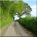
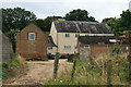
9
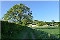
Byway with oak tree
Looking towards Purcombe Farmhouse
Image: © David Lally
Taken: 20 May 2015
0.17 miles
10
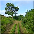
Oak beside a track
On the western side of Coppet Hill
Image: © David Lally
Taken: 19 May 2015
0.22 miles