IMAGES TAKEN NEAR TO
Lower Sea Lane, BRIDPORT, DT6 6LL
Introduction
This page details the photographs taken nearby to Lower Sea Lane, DT6 6LL by members of the Geograph project.
The Geograph project started in 2005 with the aim of publishing, organising and preserving representative images for every square kilometre of Great Britain, Ireland and the Isle of Man.

There are currently over 7.5m images from over14,400 individuals and you can help contribute to the project by visiting https://www.geograph.org.uk
Image Map
Images are licensed for reuse under creativecommons.org/licenses/by-sa/2.0
Notes
- Clicking on the map will re-center to the selected point.
- The higher the marker number, the further away the image location is from the centre of the postcode.
Image Listing (165 Images Found)
Images are licensed for reuse under creativecommons.org/licenses/by-sa/2.0
Image
Details
Distance
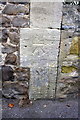
2
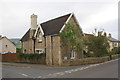
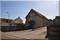
The Old School, Lower Sea Lane
There is an OS benchmark Image on the second corner stone above the pavement of Wesley Close, the road going left at the junction
Image: © Roger Templeman
Taken: 9 Sep 2012
0.03 miles
3
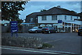
Charmouth : Hensleigh House & Restaurant
Hensleigh house is a hotel, but the tourist board say it can't be called one officially because it doesn't serve food every day of the year.
Image: © Lewis Clarke
Taken: 30 Sep 2010
0.04 miles
4
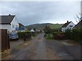
Meadow Way, Charmouth
A private residential road with a view beyond to Stonebarrow Hill
Image: © David Smith
Taken: 15 Jan 2014
0.04 miles
5
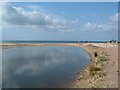
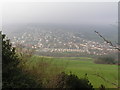
Charmouth, Where the River Char meets the sea
Image: © Paul Allison
Taken: Unknown
0.04 miles
6
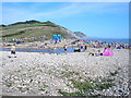
Charmouth, Dorset.
The beach at Charmouth in Dorset looking East.
Image: © Steve Chapple
Taken: 28 Aug 2005
0.04 miles
7
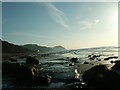
Low tide looking east towards Charmouth
Image: © Sarah Worner
Taken: 10 Feb 2006
0.04 miles
8
Charmouth : St Andrews Community Hall
The church hall on Lower Sea Lane in Charmouth.
Image: © Lewis Clarke
Taken: 6 Jul 2013
0.04 miles

10
Benchmark on the Old School, Lower Sea Lane
Ordnance Survey cut mark benchmark described on the Bench Mark Database at http://www.bench-marks.org.uk/bm43902
Image: © Roger Templeman
Taken: 9 Sep 2012
0.04 miles