IMAGES TAKEN NEAR TO
Crook Hill, BRIDPORT, DT6 5LX
Introduction
This page details the photographs taken nearby to Crook Hill, DT6 5LX by members of the Geograph project.
The Geograph project started in 2005 with the aim of publishing, organising and preserving representative images for every square kilometre of Great Britain, Ireland and the Isle of Man.

There are currently over 7.5m images from over14,400 individuals and you can help contribute to the project by visiting https://www.geograph.org.uk
Image Map
Images are licensed for reuse under creativecommons.org/licenses/by-sa/2.0
Notes
- Clicking on the map will re-center to the selected point.
- The higher the marker number, the further away the image location is from the centre of the postcode.
Image Listing (118 Images Found)
Images are licensed for reuse under creativecommons.org/licenses/by-sa/2.0
Image
Details
Distance
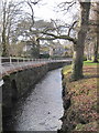
1
Netherbury village at bridge over River Brit
Image: © Maurice D Budden
Taken: 14 Jan 2005
0.10 miles
2
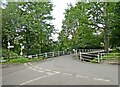
Bridge over the River Brit, Netherbury
Image: © Roger Cornfoot
Taken: 16 Aug 2023
0.10 miles
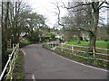
4
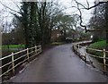
Bridge Street running into Netherbury
Standing on the bridge over the River Brit
Image: © Tim Heaton
Taken: 28 Jan 2013
0.12 miles
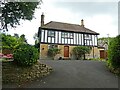
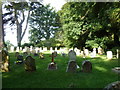
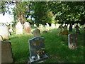
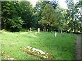
7
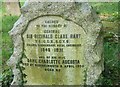
St Mary, Netherbury: churchyard (24)
For more details see https://en.wikipedia.org/wiki/Reginald_Clare_Hart
Image: © Basher Eyre
Taken: 4 Sep 2013
0.15 miles