IMAGES TAKEN NEAR TO
Cleals Buildings, BRIDPORT, DT6 3PQ

Introduction

This page details the photographs taken nearby to Cleals Buildings, DT6 3PQ by members of the Geograph project.

The Geograph project started in 2005 with the aim of publishing, organising and preserving representative images for every square kilometre of Great Britain, Ireland and the Isle of Man.

There are currently over 7.5m images from over14,400 individuals and you can help contribute to the project by visiting https://www.geograph.org.uk

Image Map


Images are licensed for reuse under creativecommons.org/licenses/by-sa/2.0
Notes
  • Clicking on the map will re-center to the selected point.
  • The higher the marker number, the further away the image location is from the centre of the postcode.

Image Listing (508 Images Found)

Images are licensed for reuse under creativecommons.org/licenses/by-sa/2.0
  • ...
Image
Details
Distance
1
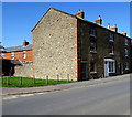
Three-storey houses on the west side of South Street, Bridport
The grass and posts are on the corner of South Walk.
Image: © Jaggery Taken: 25 Aug 2017
0.01 miles
2
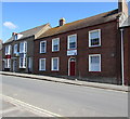
South Street, Bridport...
...lined with attractive Georgian cottages. The road (the B3157) leads to West Bay about 3 km to the south.
Image: © Bill Harrison Taken: 9 Jul 2016
0.01 miles
3
St Mary's Place, Bridport
Alleyway leading to houses on the west side of South Street.
Image: © Jaggery Taken: 25 Aug 2017
0.02 miles
4
Kingdom Hall of Jehovah's Witnesses, Bridport
At 135 South Street. Jehovah's Witnesses use Kingdom Hall to describe their places of worship because the biblical use of church usually refers to the congregation of people rather than a structure.
Image: © Jaggery Taken: 25 Aug 2017
0.02 miles
5
Where is number 98 South Street, Bridport?
The number 100 is on the doorframe above the blue door centre left. The number 96 is on the yellow door. Number 94 is on the right. Where is number 98?
Image: © Jaggery Taken: 25 Aug 2017
0.02 miles
6
Normandy Way, Bridport
On the north side of South Walk.
Image: © Jaggery Taken: 25 Aug 2017
0.02 miles
7
Houses on South St
These terraced houses are on the east side of South St Opposite St Mary's church. Several of the houses are made from brick with the lower courses of the wall made of Bothenhampton Stone. This is a local stone that is impervious to water and acts as a damp proof barrier. The Bothenhampton stone was once known as Baunton stone. The houses would originally have had long narrow rear gardens as most of them were built for out-workers of Bridport's rope and twine industry.
Image: © Nigel Mykura Taken: 8 Jan 2015
0.02 miles
8
Oldest house in Bridport
The estate agent board outside the house on the corner of South Walk and South Street states that this is the oldest house in Bridport. Dating from the 14th or 15th century, with later alterations, the building was Grade II (star) listed in 1950 as The Chantry, 128 South Street, Bridport.
Image: © Jaggery Taken: 25 Aug 2017
0.02 miles
9
South St
Image: © N Chadwick Taken: 28 Dec 2011
0.02 miles
10
South Street Bridport
Looking north
Image: © Chris Gunns Taken: 22 Sep 2018
0.02 miles
  • ...