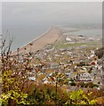
IMAGES TAKEN NEAR TO
Harbour View Road, PORTLAND, DT5 1EN

Introduction

This page details the photographs taken nearby to Harbour View Road, DT5 1EN by members of the Geograph project.

The Geograph project started in 2005 with the aim of publishing, organising and preserving representative images for every square kilometre of Great Britain, Ireland and the Isle of Man.

There are currently over 7.5m images from over14,400 individuals and you can help contribute to the project by visiting https://www.geograph.org.uk

Image Map


Images are licensed for reuse under creativecommons.org/licenses/by-sa/2.0
Notes
  • Clicking on the map will re-center to the selected point.
  • The higher the marker number, the further away the image location is from the centre of the postcode.

Image Listing (185 Images Found)

Images are licensed for reuse under creativecommons.org/licenses/by-sa/2.0
  • ...
Image
Details
Distance
1
Chiswell in early evening light
Image: © Peter S Taken: 7 Aug 2019
0.01 miles
2
Portland: postbox № DT5 120, Coronation Road
This George VI-reign box is on the steep corner of Harbour View Road and Coronation Road. The roads on this side of Portland tackle the steepness with a series of sharp zigzag turns.
Image: © Chris Downer Taken: 27 Dec 2008
0.02 miles
3
View across the rooftops of Chiswell 1962
Quite a few changes have taken place over the years. The number of storage tanks has reduced by a half and the sailing academy introduced. Chesil Beach disappears in the distance.
Image: © Gordon Spicer Taken: Unknown
0.06 miles
4
Fortuneswell and Chesil Beach
This extensive view is from the viewpoint high above the town on the way to the prison.
Image: © Flying Stag Taken: 14 Oct 2008
0.07 miles
5
View over Fortuneswell
Image: © Oast House Archive Taken: 15 Sep 2019
0.07 miles
6
Junction of Victory Road and Castle Road,Fortuneswell
Image: © Chris Gunns Taken: 25 May 2009
0.07 miles
7
Fortuneswell from Castletown
Fortuneswell viewed from Castletown
Image: © Dave Mobley Taken: 9 Jul 2006
0.07 miles
8
Fortuneswell
Image: © N Chadwick Taken: 29 Dec 2018
0.08 miles
9
Benchmark on 'The Court House', Castle Road
Ordnance Survey cut mark benchmark described on the Bench Mark Database at http://www.bench-marks.org.uk/bm40296
Image: © Roger Templeman Taken: 22 Nov 2011
0.08 miles
10
'The Court House', Castle Road
Former police station with an OS benchmark Image on the side of the porch
Image: © Roger Templeman Taken: 22 Nov 2011
0.08 miles
  • ...