IMAGES TAKEN NEAR TO
Puncknowle, DORCHESTER, DT2 9BT
Introduction
This page details the photographs taken nearby to DT2 9BT by members of the Geograph project.
The Geograph project started in 2005 with the aim of publishing, organising and preserving representative images for every square kilometre of Great Britain, Ireland and the Isle of Man.

There are currently over 7.5m images from over14,400 individuals and you can help contribute to the project by visiting https://www.geograph.org.uk
Image Map
Images are licensed for reuse under creativecommons.org/licenses/by-sa/2.0
Notes
- Clicking on the map will re-center to the selected point.
- The higher the marker number, the further away the image location is from the centre of the postcode.
Image Listing (14 Images Found)
Images are licensed for reuse under creativecommons.org/licenses/by-sa/2.0
Image
Details
Distance
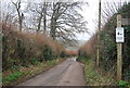
1
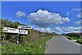
Puncknowle: Where Litton Lane joins Rectory Lane
Image: © Michael Garlick
Taken: 18 Apr 2019
0.10 miles
2
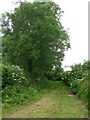
Puncknowle: black cat on green lane
A black cat relaxes in the middle of this grass track off Rectory Lane.
Image: © Chris Downer
Taken: 13 Jun 2009
0.16 miles
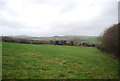
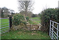
4

Gateway and fields near Puncknowle
These fields are just north of the village on Hazel Lane
Image: © Nigel Mykura
Taken: 18 Jan 2009
0.17 miles