IMAGES TAKEN NEAR TO
Orchard Lane, BLANDFORD FORUM, DT11 9BF
Introduction
This page details the photographs taken nearby to Orchard Lane, DT11 9BF by members of the Geograph project.
The Geograph project started in 2005 with the aim of publishing, organising and preserving representative images for every square kilometre of Great Britain, Ireland and the Isle of Man.

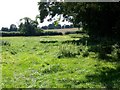
There are currently over 7.5m images from over14,400 individuals and you can help contribute to the project by visiting https://www.geograph.org.uk
Image Map (Loading...)


Getting Data...Please wait
Leaflet Map data © OpenStreetMap
Images are licensed for reuse under creativecommons.org/licenses/by-sa/2.0
Notes
- Clicking on the map will re-center to the selected point.
- The higher the marker number, the further away the image location is from the centre of the postcode.
Image Listing (71 Images Found)
Images are licensed for reuse under creativecommons.org/licenses/by-sa/2.0
Image
Details
Distance
2
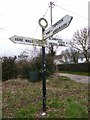
Old Direction Sign - Signpost by Bere Road, Winterborne Kingston
Annulus finial - 3 arms; Dorset halo without NGR by the UC road, in parish of Winterborne Kingston (North Dorset District), Bere Road at junction with Duck Street, the UC road to Winterborne Anderson, on verge.
Surveyed
Milestone Society National ID: DO_SY8697B
Image: © Milestone Society
Taken: Unknown
0.08 miles
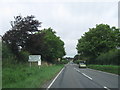
5
Bridleway, Winterborne Kingston
The short stretch of bridleway follows the hedge line to join another bridleway that takes walkers and riders to Bere Down.
Image: © Maigheach-gheal
Taken: 13 Sep 2009
0.09 miles
7
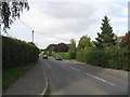
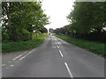
Winterborne Kingston
View east along West St,the road into the village from Winterborne Whitechurch. Taken from near the junction with Plumley Meadows.
Image: © Nigel Mykura
Taken: 11 Oct 2009
0.09 miles
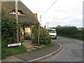
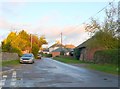
8
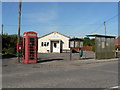
Winterborne Kingston: postbox № DT11 90 and phone
These two red objects, plus noticeboard and bus stop, are outside the village hall (see Image).
Image: © Chris Downer
Taken: 21 Sep 2008
0.10 miles
10
Winterborne Kingston, old chapel
Converted Wesleyan chapel, dated 1872, in Church Street next to Image; now used for residential purposes, and currently to rent.
Image: © Mike Faherty
Taken: 27 Jun 2009
0.10 miles