IMAGES TAKEN NEAR TO
Westwoodside, DONCASTER, DN9 2ER
Introduction
This page details the photographs taken nearby to DN9 2ER by members of the Geograph project.
The Geograph project started in 2005 with the aim of publishing, organising and preserving representative images for every square kilometre of Great Britain, Ireland and the Isle of Man.

There are currently over 7.5m images from over14,400 individuals and you can help contribute to the project by visiting https://www.geograph.org.uk
Image Map
Images are licensed for reuse under creativecommons.org/licenses/by-sa/2.0
Notes
- Clicking on the map will re-center to the selected point.
- The higher the marker number, the further away the image location is from the centre of the postcode.
Image Listing (8 Images Found)
Images are licensed for reuse under creativecommons.org/licenses/by-sa/2.0
Image
Details
Distance
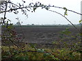
1
Middle Broomston Farm
On a murky November day.
Image: © Jonathan Thacker
Taken: 11 Nov 2011
0.01 miles
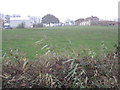
5
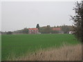
Little Broomston
Seen from Broomston Lane.
Image: © Jonathan Thacker
Taken: 11 Nov 2011
0.15 miles
6
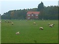
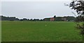
Sheep grazing
In a field near Little Broomston Farm
Image: © Graham Hogg
Taken: 24 Oct 2019
0.17 miles
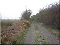
7
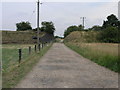
Missing Bridge
The missing bridge from this disused railway line is nothing compared to the embankment that once carried the railway west of here. Where it ran the field is now flat with no sign at all that the railway was ever there.
Image: © Michael Patterson
Taken: 4 Aug 2006
0.23 miles