
IMAGES TAKEN NEAR TO
Northfield Close, DONCASTER, DN6 9AB
Introduction
This page details the photographs taken nearby to Northfield Close, DN6 9AB by members of the Geograph project.
The Geograph project started in 2005 with the aim of publishing, organising and preserving representative images for every square kilometre of Great Britain, Ireland and the Isle of Man.

There are currently over 7.5m images from over14,400 individuals and you can help contribute to the project by visiting https://www.geograph.org.uk
Image Map
Images are licensed for reuse under creativecommons.org/licenses/by-sa/2.0
Notes
- Clicking on the map will re-center to the selected point.
- The higher the marker number, the further away the image location is from the centre of the postcode.
Image Listing (56 Images Found)
Images are licensed for reuse under creativecommons.org/licenses/by-sa/2.0
Image
Details
Distance
1
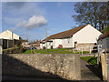
Northfields
A small development of sheltered housing in Womersley.
Image: © Alan Murray-Rust
Taken: 24 Dec 2013
0.03 miles
2
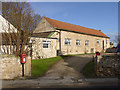
Womersley Village Hall
This gives the impression of being converted from a barn.
Image: © Alan Murray-Rust
Taken: 24 Dec 2013
0.04 miles
4
Junction with Northfield Close
Looking along Northfield Lane in Womersley.
Image: © DS Pugh
Taken: 24 Feb 2024
0.04 miles
5
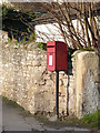
Wormsley (sic) P.O. Postbox, ref DN6 208
Standard E II R lamp box. The village no longer has its own Post Office.
Image: © Alan Murray-Rust
Taken: 24 Dec 2013
0.04 miles
6
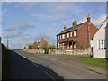
Northfield Lane
The main road out of Womersley towards Knottingley.
Image: © Alan Murray-Rust
Taken: 24 Dec 2013
0.04 miles
7
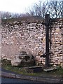
Village antiques
On the left is the stump of the medieval village cross, and to the right is the cast iron pump of 1842. Magnesian limestone walling behind.
Image: © Gordon Hatton
Taken: 9 Jan 2011
0.05 miles
8
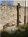
Medieval cross and village pump
See http://www.geograph.org.uk/photo/3792948 for more information.
Image: © Alan Murray-Rust
Taken: 24 Dec 2013
0.05 miles
9
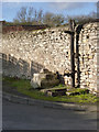
Roadside pump at Womersley
This is an unusually large specimen, and is unusual in having two spouts, one at high level. This could be used for filling water carts which would distribute water before mains water was laid on.
According to the English Heritage listing it reputedly dates from 1842. Beyond are the remains of a medieval stone cross. Both are Listed Grade II.
Image: © Alan Murray-Rust
Taken: 24 Dec 2013
0.05 miles
10
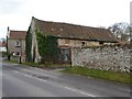
Barn with a dilapidated roof, Womersley
Park Farm, on the south side of Main Street.
Image: © Christine Johnstone
Taken: 19 Feb 2014
0.06 miles