IMAGES TAKEN NEAR TO
Springwell Lane, DONCASTER, DN4 9AB
Introduction
This page details the photographs taken nearby to Springwell Lane, DN4 9AB by members of the Geograph project.
The Geograph project started in 2005 with the aim of publishing, organising and preserving representative images for every square kilometre of Great Britain, Ireland and the Isle of Man.

There are currently over 7.5m images from over14,400 individuals and you can help contribute to the project by visiting https://www.geograph.org.uk
Image Map
Images are licensed for reuse under creativecommons.org/licenses/by-sa/2.0
Notes
- Clicking on the map will re-center to the selected point.
- The higher the marker number, the further away the image location is from the centre of the postcode.
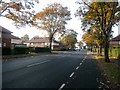
Image Listing (15 Images Found)
Images are licensed for reuse under creativecommons.org/licenses/by-sa/2.0
Image
Details
Distance
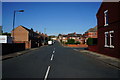
3
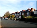
Victorian Villas on Ashfield Road
Image: © Jonathan Clitheroe
Taken: 31 Oct 2016
0.11 miles
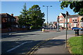
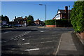
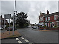
8
Warde Avenue junction
Junction with the Balby Road into Doncaster from Rotherham.
Image: © Steve Fareham
Taken: 16 Oct 2007
0.19 miles
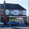
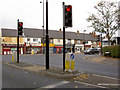
10
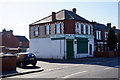
Raja's Off Licence on Springwell Lane, Doncaster
Image: © Ian S
Taken: 17 May 2014
0.20 miles