IMAGES TAKEN NEAR TO
Bridgelake Drive, DONCASTER, DN4 8SD
Introduction
This page details the photographs taken nearby to Bridgelake Drive, DN4 8SD by members of the Geograph project.
The Geograph project started in 2005 with the aim of publishing, organising and preserving representative images for every square kilometre of Great Britain, Ireland and the Isle of Man.

There are currently over 7.5m images from over14,400 individuals and you can help contribute to the project by visiting https://www.geograph.org.uk
Image Map
Images are licensed for reuse under creativecommons.org/licenses/by-sa/2.0
Notes
- Clicking on the map will re-center to the selected point.
- The higher the marker number, the further away the image location is from the centre of the postcode.
Image Listing (9 Images Found)
Images are licensed for reuse under creativecommons.org/licenses/by-sa/2.0
Image
Details
Distance
1
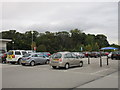
Tesco carpark
Woodfield Plantation beyond. Woodfield Plantation appears to be the name being given to the whole of this rapidly expanding neighbourhood.
Image: © Jonathan Thacker
Taken: 10 Oct 2015
0.14 miles
2
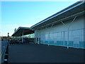
Doncaster Tesco Extra
erm, pretty much does what is says on the tin - Tesco and just about everything else under the sun, even kitchen sinks too.
Image: © Paul Johnston-Knight
Taken: 4 Mar 2006
0.18 miles
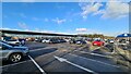
4

Tesco Extra, Potteric Carr, Doncaster
Image: © Mike Pennington
Taken: 20 Apr 2022
0.19 miles

6
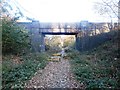
Bridge Over Disused Railway Line
This is Occupation Railway Bridge (number 7.079) passing over a former mineral line which served Yorkshire Main Colliery.
Image: © Jonathan Clitheroe
Taken: 2 Nov 2016
0.19 miles
8
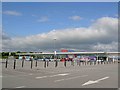
Early morning in Tesco's car park
Almost in the middle of nowhere.
Image: © Steve Fareham
Taken: 10 Jun 2008
0.22 miles