IMAGES TAKEN NEAR TO
Stoops Lane, DONCASTER, DN4 7RY
Introduction
This page details the photographs taken nearby to Stoops Lane, DN4 7RY by members of the Geograph project.
The Geograph project started in 2005 with the aim of publishing, organising and preserving representative images for every square kilometre of Great Britain, Ireland and the Isle of Man.

There are currently over 7.5m images from over14,400 individuals and you can help contribute to the project by visiting https://www.geograph.org.uk
Image Map
Images are licensed for reuse under creativecommons.org/licenses/by-sa/2.0
Notes
- Clicking on the map will re-center to the selected point.
- The higher the marker number, the further away the image location is from the centre of the postcode.
Image Listing (16 Images Found)
Images are licensed for reuse under creativecommons.org/licenses/by-sa/2.0
Image
Details
Distance
1
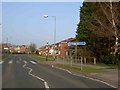
Greenway crossing
Bessacarr Doncaster.
Image: © Steve Fareham
Taken: 21 Mar 2009
0.07 miles
3
New Neighbours
The new houses between the trees are two miles away by road since a railway line runs beyond the fence.
Image: © Michael Patterson
Taken: 7 Aug 2006
0.11 miles
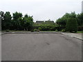
5
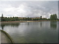
The Lake, Doncaster Lakeside (3)
Showing some of the housing development close to this artificial lake.
Image: © Jonathan Thacker
Taken: 26 Sep 2012
0.14 miles
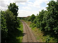
6

Doncaster : Lakeside Lake
Looking across the lake.
Image: © Lewis Clarke
Taken: 21 Sep 2020
0.15 miles
7

Doncaster : Lakeside Lake
Looking across Lakeside Lake.
Image: © Lewis Clarke
Taken: 21 Sep 2020
0.16 miles
8

Doncaster : Lakeside Lake
Looking across the lake.
Image: © Lewis Clarke
Taken: 21 Sep 2020
0.16 miles
9

Doncaster : Lakeside Lake
A footpath heads around the lake.
Image: © Lewis Clarke
Taken: 21 Sep 2020
0.17 miles
10

Doncaster : Lakeside Lake
A footpath heading around Lakeside Lake.
Image: © Lewis Clarke
Taken: 21 Sep 2020
0.17 miles