
IMAGES TAKEN NEAR TO
Long Close, DONCASTER, DN4 7PW
Introduction
This page details the photographs taken nearby to Long Close, DN4 7PW by members of the Geograph project.
The Geograph project started in 2005 with the aim of publishing, organising and preserving representative images for every square kilometre of Great Britain, Ireland and the Isle of Man.

There are currently over 7.5m images from over14,400 individuals and you can help contribute to the project by visiting https://www.geograph.org.uk
Image Map
Images are licensed for reuse under creativecommons.org/licenses/by-sa/2.0
Notes
- Clicking on the map will re-center to the selected point.
- The higher the marker number, the further away the image location is from the centre of the postcode.
Image Listing (7 Images Found)
Images are licensed for reuse under creativecommons.org/licenses/by-sa/2.0
Image
Details
Distance
1
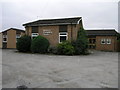
Bessacarr Evangelical
Bessacarr Evangelical church welcomes all according to the sign by the road. Don't take a camera with you though when the lady that does the gardening is around, she is not very welcoming at all.
Image: © Michael Patterson
Taken: 7 Aug 2006
0.07 miles
2
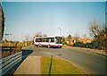
Bus on Bessacarr Lane, Bessacarr
First South Yorkshire 40489, a Volvo B6LE/Wright Crusader (with original style raised bodyside window line), uses the north end of Bessacarr Lane to access the bus turning circle off Stoops Lane (left) while working route 58 from Doncaster town centre.
Image: © Richard Vince
Taken: 16 Feb 2008
0.10 miles
3
Stoops Lane bus stop Bessacarr
Turn left for Doncaster's green way and the bridleway to Loversall.
Image: © Steve Fareham
Taken: 21 Mar 2009
0.10 miles
4
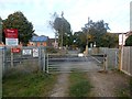
Carr Lane Railway Crossing
Looking across the track towards Bessacarr.
Image: © Jonathan Clitheroe
Taken: 25 Oct 2016
0.14 miles
6
The park at Bolton Hill
Taken from The Great North Road.
Image: © Ian S
Taken: 25 Feb 2012
0.20 miles
7
Bridleway to Bessacarr
Just a short distance from the suburban sprawl that is Bessacarr.
Image: © Jonathan Thacker
Taken: 24 May 2014
0.22 miles