IMAGES TAKEN NEAR TO
Hollywell Drive, DONCASTER, DN4 6ET
Introduction
This page details the photographs taken nearby to Hollywell Drive, DN4 6ET by members of the Geograph project.
The Geograph project started in 2005 with the aim of publishing, organising and preserving representative images for every square kilometre of Great Britain, Ireland and the Isle of Man.

There are currently over 7.5m images from over14,400 individuals and you can help contribute to the project by visiting https://www.geograph.org.uk
Image Map
Images are licensed for reuse under creativecommons.org/licenses/by-sa/2.0
Notes
- Clicking on the map will re-center to the selected point.
- The higher the marker number, the further away the image location is from the centre of the postcode.
Image Listing (5 Images Found)
Images are licensed for reuse under creativecommons.org/licenses/by-sa/2.0
Image
Details
Distance
1
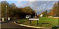
Junction with Warning Tongue Lane and the A638
Image: © Steve Fareham
Taken: 27 Nov 2008
0.24 miles
2
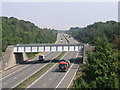
Three Bridges
Four bridges if you count the A638 that supports the camera. The railway bridge carries the Doncaster to Gainsborough line. The next bridge carries local traffic and the third one in the hazy distance carries a Roman road over the motorway from this square to the next one north.
Image: © Michael Patterson
Taken: 26 Jul 2006
0.24 miles
3
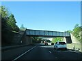
Railway bridge over M18 southbound
The bridge beyond carries the A638
Image: © Martin Dawes
Taken: 19 May 2021
0.24 miles