IMAGES TAKEN NEAR TO
Buckleigh Crescent, DN4 0GN
Introduction
This page details the photographs taken nearby to Buckleigh Crescent, DN4 0GN by members of the Geograph project.
The Geograph project started in 2005 with the aim of publishing, organising and preserving representative images for every square kilometre of Great Britain, Ireland and the Isle of Man.

There are currently over 7.5m images from over14,400 individuals and you can help contribute to the project by visiting https://www.geograph.org.uk
Image Map
Images are licensed for reuse under creativecommons.org/licenses/by-sa/2.0
Notes
- Clicking on the map will re-center to the selected point.
- The higher the marker number, the further away the image location is from the centre of the postcode.
Image Listing (31 Images Found)
Images are licensed for reuse under creativecommons.org/licenses/by-sa/2.0
Image
Details
Distance
2
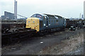
Awaiting a Decision
Class 55, 55004 "Queen's Own Highlander", stands in Canal Sidings at Doncaster Works amid condemned wagons. Built in 1961, she was one of the 22 Deltics introduced to handle the prestige express trains of the East Coast mainline including The Flying Scotsman. Initially viewed as a 10 year stopgap until electrification was carried out, the Deltics remained the top link until the HST's arrived in the late 1970's. By the time this photo was taken the writing was on the wall for the class as a whole though they would continue in service until the last three survivors were withdrawn in 1982.
In this view, 55004 is in limbo - arriving at Doncaster Works for an unclassified repair in April 1978, she was stored 'unservicable' due to a chronic shortage of power units and power unit spares. She was not withdrawn at that stage - which is why she still has her nameplates in situ. Repairs were finally sanctioned in October 1979 and she returned to service for one year before being withdrawn on 28th October 1980.
In the distance to the left of this photo is Doncaster Power Station on Crimpsall Island - since demolished and replaced by a prison. St.George's Minster is visible on the right.
Image: © Martin Addison
Taken: 25 Mar 1979
0.09 miles
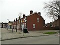
8
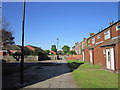
Pullman Green, Hexthorpe (2)
This is Eden Grove, off Ramsden Road where it becomes Old Hexthorpe. It is the western entrance into a large housing estate, the far end of which is still under construction, on the site of the westernmost part of Doncaster's once extensive railway engineering works Image What makes this estate unusual is that all the properties are being built for rental rather than owner-occupation.
Image: © Stephen Craven
Taken: 16 Mar 2024
0.13 miles
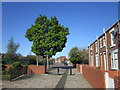
10
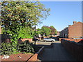
Kirk Street, Hexthorpe
The street is on of a few in the area that have been pedestrianised to the extent of no motor vehicles being allowed 'except for loading'. According to the Doncaster Free Press, this part of Hexthorpe was being plagued by antisocial behaviour, and has been made the subject of a PSPO (Public Space Protection Order) with extensive CCTV coverage. Maybe it has worked, or maybe Saturday afternoon is a quiet time anyway, but I saw no problems as I passed through.
Image: © Stephen Craven
Taken: 16 Mar 2024
0.14 miles