
IMAGES TAKEN NEAR TO
Faulding Lane, IMMINGHAM, DN40 3EE
Introduction
This page details the photographs taken nearby to Faulding Lane, DN40 3EE by members of the Geograph project.
The Geograph project started in 2005 with the aim of publishing, organising and preserving representative images for every square kilometre of Great Britain, Ireland and the Isle of Man.

There are currently over 7.5m images from over14,400 individuals and you can help contribute to the project by visiting https://www.geograph.org.uk
Image Map
Images are licensed for reuse under creativecommons.org/licenses/by-sa/2.0
Notes
- Clicking on the map will re-center to the selected point.
- The higher the marker number, the further away the image location is from the centre of the postcode.
Image Listing (29 Images Found)
Images are licensed for reuse under creativecommons.org/licenses/by-sa/2.0
Image
Details
Distance
1
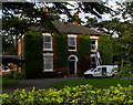
The Grange
The Grange, Faulding Lane, South Killingholme.
Image: © David Wright
Taken: 30 Sep 2006
0.02 miles
2
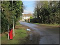
Town Street, South Killingholme
Seen at the junction with Faulding Lane; Baptist Chapel Lane is off to the right of the shot.
Image: © Paul Harrop
Taken: 19 Feb 2017
0.03 miles
3
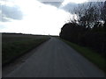
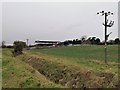
Faulding Lane heading east
Towards Habrough.
Image: © JThomas
Taken: 30 Mar 2013
0.04 miles
6
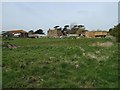
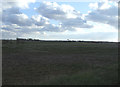
Active farm, South Killingholme
Not sure about the name but could be part of nearby Manor Farm. Judging by the height of the bale stacks things are busy here.
Image: © John Beal
Taken: 22 Apr 2008
0.05 miles
7
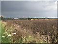
Storm brewing over South Killingholme
A field of fodder beans awaiting harvest in the foreground. It's still sunny over Immingham but getting darker here as a rainstorm moves in from the north-west.
Image: © Jonathan Thacker
Taken: 27 Aug 2011
0.08 miles
8
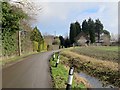
Baptist Chapel Lane, South Killingholme
At the southern edge of the village: the former chapel after which the lane is named is on the right - in a very neglected state, it does have what looked like a newly erected 'sold' sign on it, so it may be about to be rescued from complete dereliction.
Image: © Paul Harrop
Taken: 19 Feb 2017
0.08 miles
9
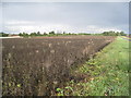
Bean field by Faulding Lane
Fodder beans awaiting harvest.
Image: © Jonathan Thacker
Taken: 27 Aug 2011
0.09 miles
10

Immingham from the air
Two former RAF airfields can be seen this side of the river. The brown V shape below the bend in the river is the former RAF Goxhill https://en.wikipedia.org/wiki/RAF_Goxhill . Former RAF North Killingholms https://en.wikipedia.org/wiki/RAF_North_Killingholme can be seen nearer the oil tanks, towards the lower left corner. Kingston Upon Hull is on the opposite bank, with the North Sea visible beyond the coast.
Image: © Thomas Nugent
Taken: 10 Feb 2014
0.10 miles